Trail Mountain bike Maussac - Au charbon ! 17km - Maussac - Pays de Haute Corrèze  - Photo

Au charbon ! 17km - Maussac - Pays de Haute Corrèze

 tracegps
tracegps

User

© OpenStreetMap contributors
Length
Length
17 km
Max alt
Max alt
712 m
Uphill gradient
Uphill gradient
380 m
Km-Effort
Km-Effort  
22 km
Min alt
Min alt
597 m
Downhill gradient
Downhill gradient
382 m
Boucle
Boucle
Yes
Creation date :
2014-12-10 00:00:00.0
Updated on :
2014-12-10 00:00:00.0

(1 Reviews)

Mountain bike
Mountain bike
1h30
Difficulty : Medium

Scan this QR Code to open this trail in the SityTrail application

FREE GPS app for hiking

Logo SityTrail SityTrail

IGN / Geographical institutes

Download SityTrail from the App Store Download SityTrail from Google Play

Logo SityTrail SityTrail World

The world is yours!

Download SityTrail from the App Store Download SityTrail from Google Play Download SityTrail on Huawei AppGallery

About

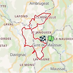
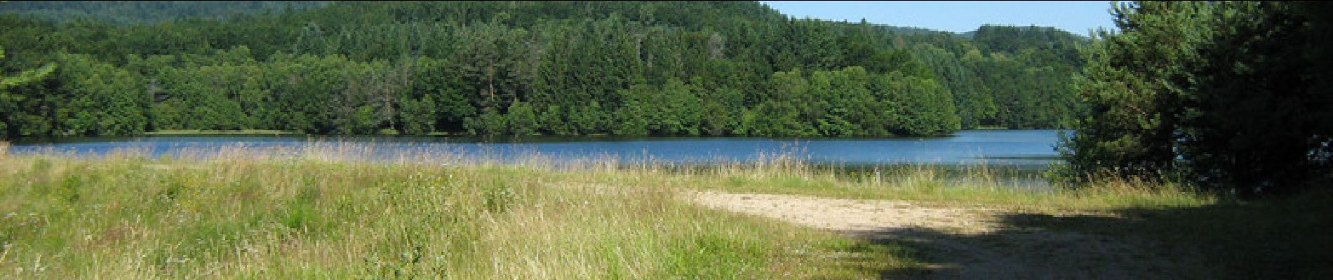
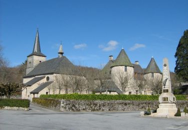
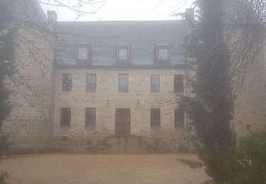
Trail Mountain bike of 17 km to be discovered at New Aquitaine, Corrèze, Maussac. This trail is proposed by tracegps.

Description

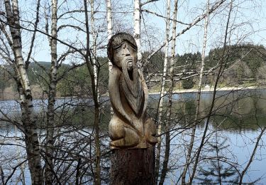
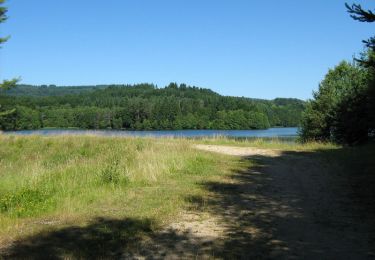
Au charbon ! 17km - Maussac - Pays de Haute Corrèze Au cours des 115 ans de son exploitation, le filon de charbon de Maussac a permis au village de Lapleau de connaître une expansion économique unique. Ce sentier vous permet de comparer les architectures traditionnelles aux équipements miniers et administratifs de ce « boom » et d’imaginer l’évolution du mode de vie dans une cité minière. Téléchargez la fiche du circuit sur le site du Conseil Général de la Corrèze. Renseignements : Office de Tourisme de Meymac 05.55.95.18.43

Elevation profile

Photos

Positioning

Country:
France
Region :
New Aquitaine
Department/Province :
Corrèze
Municipality :
Maussac
Location:
Unknown
Start:(UTM)
431855 ; 5037974 (31T) N.

Comments

Please log in to post a review or rate the element


Trails nearby

Trail Walking Meymac - De feuilles en aiguilles - Ambrugeat - Pays de Haute Corrèze  - Photo
Walking
tracegps

Walking

Difficult
(1)
Meymac, New Aquitaine, Corrèze, France
23 km | 32 km-effort
4h 30min
Yes
Trail Walking Davignac - Appellation d'Origine Non Contrôlée - Davignac - Pays de Haute Corrèze  - Photo
Walking
tracegps

Walking

Medium
(1)
Davignac, New Aquitaine, Corrèze, France
5.1 km | 7.1 km-effort
1h 10min
Yes
Trail Walking Meymac - Meymac_Davignac - Photo
Walking
viam19

Walking

Medium
Meymac, New Aquitaine, Corrèze, France
14.1 km | 18 km-effort
3h 24min
No
Trail Walking Ambrugeat - balade lac de sechemailles avec Viviane  - Photo
Walking
Nicole Cridel

Walking

Very easy
(2)
Ambrugeat, New Aquitaine, Corrèze, France
4.7 km | 5.6 km-effort
1h 32min
Yes
Trail Walking Ambrugeat - Corrèze Ambrugeat - Photo
Walking
hl44lv

Walking

Easy
Ambrugeat, New Aquitaine, Corrèze, France
14.3 km | 20 km-effort
4h 12min
Yes
Trail Mountain bike Meymac - De feuilles en aiguilles - Ambrugeat - Pays de Haute Corrèze  - Photo
Mountain bike
tracegps

Mountain bike

Difficult
Meymac, New Aquitaine, Corrèze, France
23 km | 32 km-effort
1h 30min
Yes
Trail Walking Maussac - Au charbon ! 6 km - Maussac - Pays de Haute Corrèze  - Photo
Walking
tracegps

Walking

Medium
(1)
Maussac, New Aquitaine, Corrèze, France
5.3 km | 6.8 km-effort
1h 30min
Yes
Trail Walking Maussac - Au charbon ! 17km - Maussac - Pays de Haute Corrèze  - Photo
Walking
tracegps

Walking

Difficult
Maussac, New Aquitaine, Corrèze, France
17 km | 22 km-effort
4h 0min
Yes
Trail Walking Combressol - Le chemin des Abbesses 6,9 km - Combressol - Pays de Haute Corrèze  - Photo
Walking
tracegps

Walking

Medium
Combressol, New Aquitaine, Corrèze, France
6.9 km | 8.9 km-effort
2h 0min
Yes


Close
My subscriptions