Trail Cycle Saint-André-les-Alpes - Le tour des Thorames - Saint André les Alpes - Photo
 tracegps
tracegps

User

© OpenStreetMap contributors
Length
Length
40 km
Max alt
Max alt
1169 m
Uphill gradient
Uphill gradient
614 m
Km-Effort
Km-Effort  
48 km
Min alt
Min alt
895 m
Downhill gradient
Downhill gradient
614 m
Boucle
Boucle
Yes
Creation date :
2014-12-10 00:00:00.0
Updated on :
2014-12-10 00:00:00.0

(2 Reviews)

Cycle
Cycle
2h30
Difficulty : Medium

Scan this QR Code to open this trail in the SityTrail application

FREE GPS app for hiking

Logo SityTrail SityTrail

IGN / Geographical institutes

Download SityTrail from the App Store Download SityTrail from Google Play

Logo SityTrail SityTrail World

The world is yours!

Download SityTrail from the App Store Download SityTrail from Google Play Download SityTrail on Huawei AppGallery

About

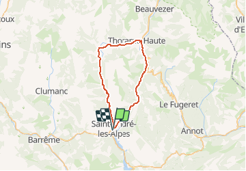
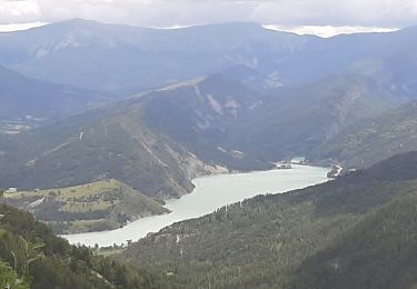
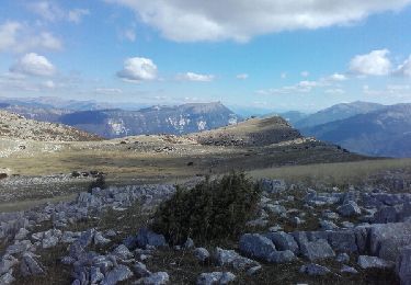
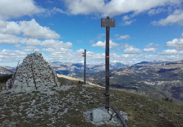
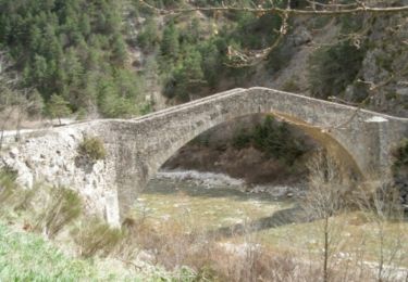
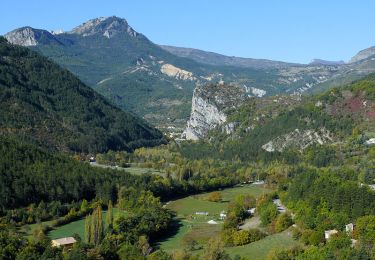
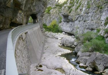
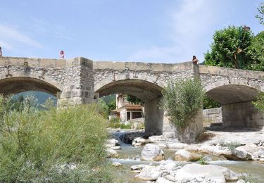
Trail Cycle of 40 km to be discovered at Provence-Alpes-Côte d'Azur, Alpes-de-Haute-Provence, Saint-André-les-Alpes. This trail is proposed by tracegps.

Description

Ce circuit vous est proposé par l'Office de Tourisme de Saint-André Les Alpes. Départ de l'office de Tourisme de Saint-André Les Alpes, place Marcel Pastorelli.

Elevation profile

Photos

Positioning

Country:
France
Region :
Provence-Alpes-Côte d'Azur
Department/Province :
Alpes-de-Haute-Provence
Municipality :
Saint-André-les-Alpes
Location:
Unknown
Start:(Dec)
Start:(UTM)
300019 ; 4871258 (32T) N.

Comments

Please log in to post a review or rate the element


Trails nearby

Trail Walking Saint-André-les-Alpes - Saint André les Alpes -Corchon - Photo
Walking
RayFab

Walking

Very difficult
Saint-André-les-Alpes, Provence-Alpes-Côte d'Azur, Alpes-de-Haute-Provence, France
15 km | 23 km-effort
5h 13min
No
Trail Walking Saint-André-les-Alpes - SAINT ANDRE LES ALPES . COURCHONS O S - Photo
Walking
RobinMicheline

Walking

Medium
(1)
Saint-André-les-Alpes, Provence-Alpes-Côte d'Azur, Alpes-de-Haute-Provence, France
13.7 km | 22 km-effort
4h 12min
Yes
Trail Walking Moriez - MORIEZ. col des Robines , le tour du Chalvet o s - Photo
Walking
RobinMicheline

Walking

Difficult
Moriez, Provence-Alpes-Côte d'Azur, Alpes-de-Haute-Provence, France
12.2 km | 22 km-effort
3h 50min
Yes
Trail Walking Saint-André-les-Alpes - sommet de l'Aup  - Photo
Walking
daniel256

Walking

Medium
Saint-André-les-Alpes, Provence-Alpes-Côte d'Azur, Alpes-de-Haute-Provence, France
26 km | 40 km-effort
5h 21min
Yes
Trail Walking Allons - puy de rent, descente par la colle  - Photo
Walking
daniel256

Walking

Medium
Allons, Provence-Alpes-Côte d'Azur, Alpes-de-Haute-Provence, France
22 km | 38 km-effort
5h 40min
Yes
Trail Cycle Saint-André-les-Alpes - Le Col des Champs - St André les Alpes - Photo
Cycle
tracegps

Cycle

Difficult
Saint-André-les-Alpes, Provence-Alpes-Côte d'Azur, Alpes-de-Haute-Provence, France
119 km | 159 km-effort
7h 0min
Yes
Trail Cycle Saint-André-les-Alpes - Le Col des Lecques - St André-les-Alpes  - Photo
Cycle
tracegps

Cycle

Difficult
Saint-André-les-Alpes, Provence-Alpes-Côte d'Azur, Alpes-de-Haute-Provence, France
57 km | 72 km-effort
4h 30min
Yes
Trail Cycle Saint-André-les-Alpes - La clue de St Auban -  St André-les-Alpes - Photo
Cycle
tracegps

Cycle

Difficult
Saint-André-les-Alpes, Provence-Alpes-Côte d'Azur, Alpes-de-Haute-Provence, France
83 km | 111 km-effort
5h 0min
Yes
Trail Cycle Saint-André-les-Alpes - La Colle Saint-Michel - St André les Alpes - Photo
Cycle
tracegps

Cycle

Difficult
Saint-André-les-Alpes, Provence-Alpes-Côte d'Azur, Alpes-de-Haute-Provence, France
68 km | 88 km-effort
4h 0min
Yes


Close
My subscriptions