


Wegscheid - Abri du Stahlberg

JCLUTT
User
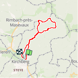

Length
12.9 km

Max alt
841 m

Uphill gradient
541 m
Km-Effort
20 km

Min alt
449 m

Downhill gradient
540 m
Boucle
Yes
Creation date :
2019-05-21 17:16:54.814
Updated on :
2019-05-21 17:16:55.209
4h29
Difficulty : Difficult

FREE GPS app for hiking
 SityTrail
IGN / Geographical institutes
SityTrail Plus
The world is yours!
About
Trail Walking of 12.9 km to be discovered at Grand Est, Haut-Rhin, Wegscheid. This trail is proposed by JCLUTT.
Description
Rando bien sportive du fait du dénivelé !
Positioning
Country:
France
Region :
Grand Est
Department/Province :
Haut-Rhin
Municipality :
Wegscheid
Location:
Unknown
Start:(Dec)
Start:(UTM)
347153 ; 5296066 (32T) N.
Comments