


Viens traces

Nathy8913
User
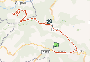

Length
14.1 km

Max alt
648 m

Uphill gradient
352 m
Km-Effort
18.7 km

Min alt
423 m

Downhill gradient
321 m
Boucle
No
Creation date :
2019-05-07 01:49:22.204
Updated on :
2019-05-07 01:49:22.204
4h28
Difficulty : Unknown

FREE GPS app for hiking
 SityTrail
IGN / Geographical institutes
SityTrail Plus
The world is yours!
About
Trail Walking of 14.1 km to be discovered at Provence-Alpes-Côte d'Azur, Vaucluse, Viens. This trail is proposed by Nathy8913.
Description
facile
Positioning
Country:
France
Region :
Provence-Alpes-Côte d'Azur
Department/Province :
Vaucluse
Municipality :
Viens
Location:
Unknown
Start:(Dec)
Start:(UTM)
704735 ; 4863414 (31T) N.
Comments