Trail Walking Figanières - Figanières 01 - Photo
© OpenStreetMap contributors
Length
Length
8.4 km
Max alt
Max alt
537 m
Uphill gradient
Uphill gradient
253 m
Km-Effort
Km-Effort  
11.8 km
Min alt
Min alt
312 m
Downhill gradient
Downhill gradient
257 m
Boucle
Boucle
Yes
Creation date :
2014-12-10 00:00:00.0
Updated on :
2014-12-10 00:00:00.0

(1 Reviews)

Walking
Walking
2h30
Difficulty : Very easy

Scan this QR Code to open this trail in the SityTrail application

FREE GPS app for hiking

Logo SityTrail SityTrail

IGN / Geographical institutes

Download SityTrail from the App Store Download SityTrail from Google Play

Logo SityTrail SityTrail World

The world is yours!

Download SityTrail from the App Store Download SityTrail from Google Play Download SityTrail on Huawei AppGallery

About

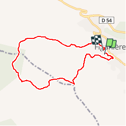
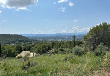
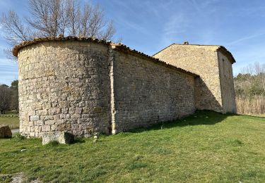
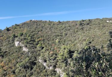
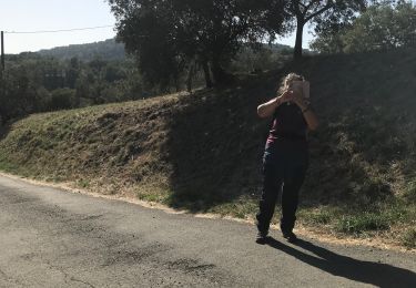
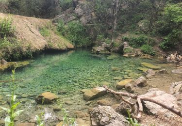
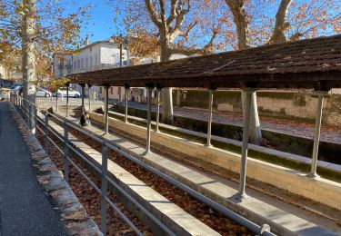
Trail Walking of 8.4 km to be discovered at Provence-Alpes-Côte d'Azur, Var, Figanières. This trail is proposed by jeanclaude83.

Description

Petite balade Figanières

Elevation profile

Positioning

Country:
France
Region :
Provence-Alpes-Côte d'Azur
Department/Province :
Var
Municipality :
Figanières
Location:
Unknown
Start:(UTM)
297715 ; 4826997 (32T) N.

Comments

Please log in to post a review or rate the element


Salut Jean Claude j'utilise aussi Sitytrail depuis 5 ans ou 6 ans Je suis à Draguignan, et tu peux ( si tu veux ) voir mes randos sous le nom de sugg. Je suis animateur au sein de l'association Restons en Forme ( FFRS ). Je vais tester la version Béta qui me parait intéressante ! De toute façon, il faudra s'y mettre !!! Cordialement Fernand


Trails nearby

Trail Walking Draguignan - Draguignan Roche aux Fées Malmont 17 km - Photo
Walking
GUIDE
rvapeldo

Walking

Medium
Draguignan, Provence-Alpes-Côte d'Azur, Var, France
17.2 km | 23 km-effort
5h 52min
Yes
Trail Walking Figanières - château château de château de la garde - Photo
Walking
ninia

Walking

Very easy
(1)
Figanières, Provence-Alpes-Côte d'Azur, Var, France
9.2 km | 11.9 km-effort
2h 48min
Yes
Trail Walking Callas - Callas- Autour de la Chapelle Saint-Auxile - Photo
Walking
Chantheys

Walking

Medium
Callas, Provence-Alpes-Côte d'Azur, Var, France
6.4 km | 9.5 km-effort
2h 9min
Yes
Trail Walking Callas - Callas fait  - Photo
Walking
ETMU5496

Walking

Medium
Callas, Provence-Alpes-Côte d'Azur, Var, France
20 km | 31 km-effort
6h 55min
Yes
Trail Walking Montferrat - La double Borie et le Beaudron . Montferrat - Photo
Walking
boulinevelyne

Walking

Difficult
(1)
Montferrat, Provence-Alpes-Côte d'Azur, Var, France
9.1 km | 14.3 km-effort
3h 15min
Yes
Trail sport Montferrat - M’ingérât - Photo
sport
jaflo

sport

Very easy
Montferrat, Provence-Alpes-Côte d'Azur, Var, France
11.6 km | 17.2 km-effort
Unknown
Yes
Trail Walking Montferrat - 20-06-2023 Pierrepont  - Photo
Walking
GUIDE
Kargil

Walking

Easy
Montferrat, Provence-Alpes-Côte d'Azur, Var, France
12.4 km | 18.3 km-effort
4h 8min
Yes
Trail Walking Draguignan - Musée de l’artillerie et cimetière américain 7 km - Photo
Walking
GUIDE
rvapeldo

Walking

Very easy
Draguignan, Provence-Alpes-Côte d'Azur, Var, France
7.3 km | 8.1 km-effort
2h 49min
Yes
Trail Walking Draguignan - Malmont 10 km - Photo
Walking
GUIDE
rvapeldo

Walking

Medium
Draguignan, Provence-Alpes-Côte d'Azur, Var, France
10.1 km | 15.2 km-effort
4h 32min
Yes


Close
My subscriptions