


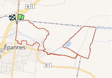
Epannes (plan d'eau). 6,8km

olaze
User

Length
6.8 km

Max alt
24 m

Uphill gradient
27 m
Km-Effort
7.2 km

Min alt
15 m

Downhill gradient
30 m
Boucle
Yes
Creation date :
2014-12-10 00:00:00.0
Updated on :
2014-12-10 00:00:00.0
1h49
Difficulty : Easy

FREE GPS app for hiking
 SityTrail
IGN / Geographical institutes
SityTrail Plus
The world is yours!
About
Trail Walking of 6.8 km to be discovered at New Aquitaine, Deux-Sèvres, Épannes. This trail is proposed by olaze.
Description
Circuit départ et retour d''Epannes. Plan d''eau d''epannes,le marais.
Club rando Bessines*
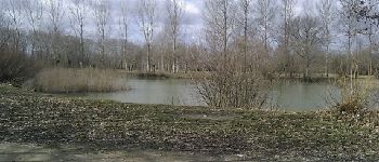
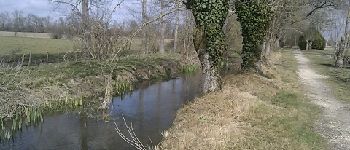
Photos
. 6,8km - Photo 1")
. 6,8km - Photo 2")


Positioning
Country:
France
Region :
New Aquitaine
Department/Province :
Deux-Sèvres
Municipality :
Épannes
Location:
Unknown
Start:(Dec)
Start:(UTM)
686281 ; 5122924 (30T) N.
Comments