Trail Walking Burdignes - Burdignes - Croix de  Chirol - Photo

Burdignes - Croix de Chirol

 tracegps
tracegps

User

© OpenStreetMap contributors
Length
Length
9.7 km
Max alt
Max alt
945 m
Uphill gradient
Uphill gradient
304 m
Km-Effort
Km-Effort  
13.7 km
Min alt
Min alt
725 m
Downhill gradient
Downhill gradient
303 m
Boucle
Boucle
Yes
Creation date :
2014-12-10 00:00:00.0
Updated on :
2014-12-10 00:00:00.0

(0 Reviews)

Walking
Walking
2h30
Difficulty : Medium

Scan this QR Code to open this trail in the SityTrail application

FREE GPS app for hiking

Logo SityTrail SityTrail

IGN / Geographical institutes

Download SityTrail from the App Store Download SityTrail from Google Play

Logo SityTrail SityTrail World

The world is yours!

Download SityTrail from the App Store Download SityTrail from Google Play Download SityTrail on Huawei AppGallery

About

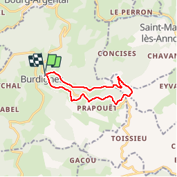
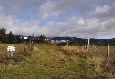
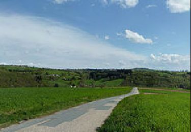
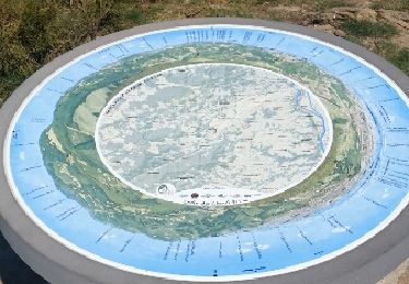
Trail Walking of 9.7 km to be discovered at Auvergne-Rhône-Alpes, Loire, Burdignes. This trail is proposed by tracegps.

Description

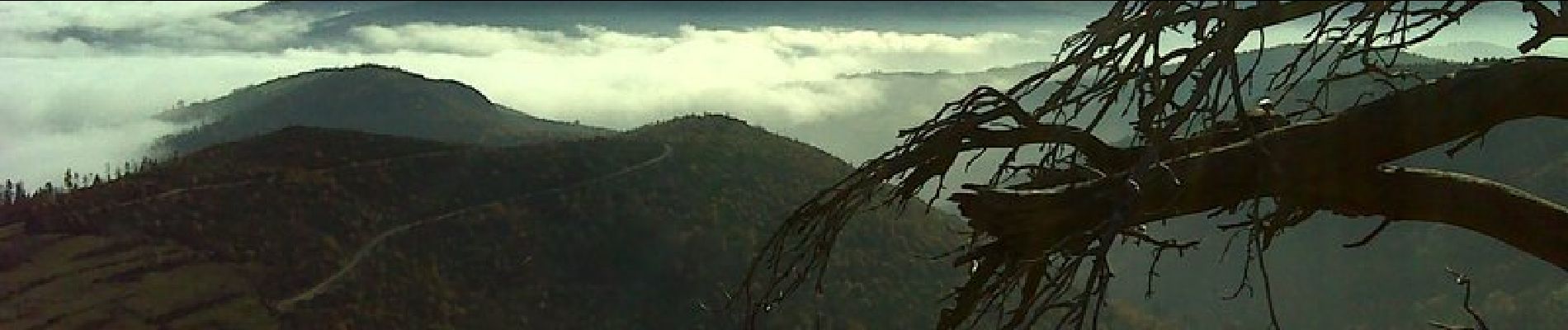
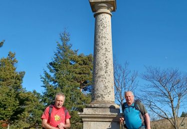
Belle promenade sur une crête ensoleillée à partir du "Bourg du feu"- Burdignes - Vue sur la vallée du Rhône et les Alpes.

Elevation profile

Photos

Positioning

Country:
France
Region :
Auvergne-Rhône-Alpes
Department/Province :
Loire
Municipality :
Burdignes
Location:
Unknown
Start:(UTM)
622850 ; 5014159 (31T) N.

Trails nearby

Trail Mountain bike Bourg-Argental - Pilat par la face sud - Photo
Mountain bike
tracegps

Mountain bike

Difficult
(1)
Bourg-Argental, Auvergne-Rhône-Alpes, Loire, France
34 km | 50 km-effort
4h 30min
Yes
Trail Walking Villevocance - la Mer de glace - Photo
Walking
jphugon

Walking

Difficult
Villevocance, Auvergne-Rhône-Alpes, Ardèche, France
11.9 km | 18.3 km-effort
6h 20min
Yes
Trail On foot Bourg-Argental - Pilat Nº2: Bourg-Argental - Le Grand Bois - Photo
On foot
PRO

On foot

Difficult
Bourg-Argental, Auvergne-Rhône-Alpes, Loire, France
22 km | 33 km-effort
7h 30min
Yes
Trail Walking Villevocance - 07 mer de glace Cx chirols - Photo
Walking
himba26100

Walking

Medium
Villevocance, Auvergne-Rhône-Alpes, Ardèche, France
14.8 km | 23 km-effort
6h 5min
Yes
Trail Walking Vanosc - Vanosc - Photo
Walking
ajd26

Walking

Easy
Vanosc, Auvergne-Rhône-Alpes, Ardèche, France
17.3 km | 27 km-effort
5h 46min
Yes
Trail Walking Bourg-Argental - Bourg Argental 2013 - Photo
Walking
tracegps

Walking

Medium
Bourg-Argental, Auvergne-Rhône-Alpes, Loire, France
22 km | 34 km-effort
6h 30min
Yes
Trail Walking Saint-Sauveur-en-Rue - La Taillairdine 2013 - St Sauveur en Rue - Photo
Walking
tracegps

Walking

Medium
Saint-Sauveur-en-Rue, Auvergne-Rhône-Alpes, Loire, France
25 km | 39 km-effort
7h 0min
Yes
Trail Walking Villevocance - croix de chirol - Photo
Walking
jphugon

Walking

Very difficult
Villevocance, Auvergne-Rhône-Alpes, Ardèche, France
17.7 km | 27 km-effort
7h 4min
Yes
Trail Other activity Burdignes - croix de Chirol - Photo
Other activity
bpc

Other activity

Very easy
Burdignes, Auvergne-Rhône-Alpes, Loire, France
18.4 km | 27 km-effort
4h 55min
Yes


Close
My subscriptions