Trail Walking Guignicourt-sur-Vence - De Guignicourt sur Vence à Gruyères par Mondigny - Photo

De Guignicourt sur Vence à Gruyères par Mondigny

 tracegps
tracegps

User

© OpenStreetMap contributors
Length
Length
14.2 km
Max alt
Max alt
308 m
Uphill gradient
Uphill gradient
331 m
Km-Effort
Km-Effort  
18.6 km
Min alt
Min alt
167 m
Downhill gradient
Downhill gradient
331 m
Boucle
Boucle
Yes
Creation date :
2014-12-10 00:00:00.0
Updated on :
2014-12-10 00:00:00.0

(0 Reviews)

Walking
Walking
2h49
Difficulty : Medium

Scan this QR Code to open this trail in the SityTrail application

FREE GPS app for hiking

Logo SityTrail SityTrail

IGN / Geographical institutes

Download SityTrail from the App Store Download SityTrail from Google Play

Logo SityTrail SityTrail World

The world is yours!

Download SityTrail from the App Store Download SityTrail from Google Play Download SityTrail on Huawei AppGallery

About

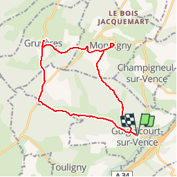
Trail Walking of 14.2 km to be discovered at Grand Est, Ardennes, Guignicourt-sur-Vence. This trail is proposed by tracegps.

Description

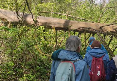
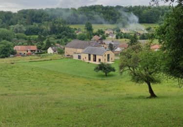
Partant de l'église de Guignicourt sur Vence vous passez devant le château puis après une longue traversée de forêt vous arrivez au village de Montdigny avec des maisons anciennes. Puis direction Gruyères (très joli château du xv et xviii ) ensuite forte montée puis à travers bois descente vers le point de départ. Avantages de cette randonnée: relief des collines pré-ardennaises, forêt, châteaux, maisons typiques.

Elevation profile

Photos

Positioning

Country:
France
Region :
Grand Est
Department/Province :
Ardennes
Municipality :
Guignicourt-sur-Vence
Location:
Unknown
Start:(UTM)
619128 ; 5504427 (31U) N.

Trails nearby

Trail Walking Saint-Pierre-sur-Vence - De St Pierre sur Vence à Champigneul sur Vence - Photo
Walking
tracegps

Walking

Difficult
Saint-Pierre-sur-Vence, Grand Est, Ardennes, France
10.5 km | 12.9 km-effort
3h 0min
Yes
Trail Walking Guignicourt-sur-Vence - guignicourt sv - Photo
Walking
labotte

Walking

Easy
Guignicourt-sur-Vence, Grand Est, Ardennes, France
11.3 km | 14.7 km-effort
3h 13min
Yes
Trail Mountain bike Gruyères - randonnee-34661010 - Photo
Mountain bike
martine08

Mountain bike

Medium
Gruyères, Grand Est, Ardennes, France
22 km | 27 km-effort
1h 53min
Yes
Trail Walking Poix-Terron - poix terron   - Photo
Walking
Nicolesophie08

Walking

Medium
Poix-Terron, Grand Est, Ardennes, France
14 km | 17.9 km-effort
3h 32min
Yes
Trail Walking Boulzicourt - boulzicourt  - Photo
Walking
Nicolesophie08

Walking

Difficult
Boulzicourt, Grand Est, Ardennes, France
12.8 km | 17.2 km-effort
3h 27min
Yes
Trail Walking Gruyères - Gruyère Réalisé le 02 08 2021  - Photo
Walking
Superpape

Walking

Difficult
Gruyères, Grand Est, Ardennes, France
12 km | 15.2 km-effort
2h 34min
Yes
Trail Walking Gruyères - Gruyère 29-06-21 - Photo
Walking
labotte

Walking

Easy
Gruyères, Grand Est, Ardennes, France
12 km | 15.2 km-effort
2h 36min
Yes
Trail Walking Boulzicourt - boulzicourt  - Photo
Walking
Nicolesophie08

Walking

Medium
Boulzicourt, Grand Est, Ardennes, France
11.9 km | 15.8 km-effort
3h 6min
Yes
Trail Walking Boulzicourt - boulzicourt.    - Photo
Walking
gilbertwarin08

Walking

Easy
Boulzicourt, Grand Est, Ardennes, France
8.4 km | 11.1 km-effort
2h 50min
Yes


Close
My subscriptions