Trail Walking Mazaye - Boucle à Mazaye - Photo
 tracegps
tracegps

User

© OpenStreetMap contributors
Length
Length
14.3 km
Max alt
Max alt
844 m
Uphill gradient
Uphill gradient
256 m
Km-Effort
Km-Effort  
17.7 km
Min alt
Min alt
705 m
Downhill gradient
Downhill gradient
256 m
Boucle
Boucle
Yes
Creation date :
2014-12-10 00:00:00.0
Updated on :
2014-12-10 00:00:00.0

(0 Reviews)

Walking
Walking
3h25
Difficulty : Medium

Scan this QR Code to open this trail in the SityTrail application

FREE GPS app for hiking

Logo SityTrail SityTrail

IGN / Geographical institutes

Download SityTrail from the App Store Download SityTrail from Google Play

Logo SityTrail SityTrail World

The world is yours!

Download SityTrail from the App Store Download SityTrail from Google Play Download SityTrail on Huawei AppGallery

About

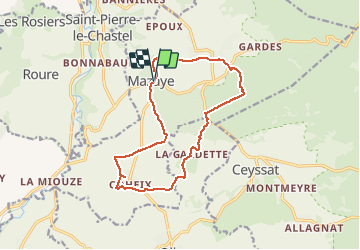
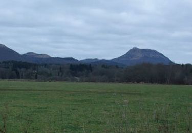
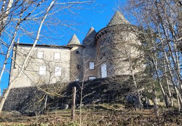
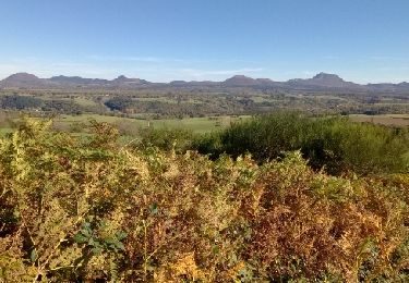
Trail Walking of 14.3 km to be discovered at Auvergne-Rhône-Alpes, Puy-de-Dôme, Mazaye. This trail is proposed by tracegps.

Description

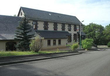
Un parcours très facile; à faire en famille, larges chemins jamais boueux! Parking à Mazaye près de la mairie et du gite d'étape

Elevation profile

Photos

Points of interest

Point of interest Mazaye - départ - Photo
tracegps
MAZAYE 

Positioning

Country:
France
Region :
Auvergne-Rhône-Alpes
Department/Province :
Puy-de-Dôme
Municipality :
Mazaye
Location:
Unknown
Start:(UTM)
489155 ; 5070263 (31T) N.

Trails nearby

Trail Walking Mazaye - Mazaye - Photo
Walking
Gegetop

Walking

Easy
(1)
Mazaye, Auvergne-Rhône-Alpes, Puy-de-Dôme, France
14.5 km | 18 km-effort
3h 29min
Yes
Trail Walking Gelles -  La roche branlante de Gelles - Photo
Walking
tracegps

Walking

Easy
(1)
Gelles, Auvergne-Rhône-Alpes, Puy-de-Dôme, France
7 km | 8.6 km-effort
2h 0min
Yes
Trail Walking Mazaye - Autour de Mazayes - Photo
Walking
tracegps

Walking

Difficult
(1)
Mazaye, Auvergne-Rhône-Alpes, Puy-de-Dôme, France
19.3 km | 24 km-effort
5h 40min
Yes
Trail Walking Ceyssat - Ceyssat_Olby_Foker - Photo
Walking
GUIDE
jagarnier

Walking

Medium
Ceyssat, Auvergne-Rhône-Alpes, Puy-de-Dôme, France
14.3 km | 17.9 km-effort
4h 15min
Yes
Trail On foot Mazaye - Saint-Pierre-le-Chastel - Photo
On foot
PRO

On foot

Easy
Mazaye, Auvergne-Rhône-Alpes, Puy-de-Dôme, France
6.9 km | 9 km-effort
2h 3min
No
Trail Walking Ceyssat - Allagnat - Photo
Walking
force

Walking

Very difficult
Ceyssat, Auvergne-Rhône-Alpes, Puy-de-Dôme, France
11.7 km | 14.8 km-effort
3h 51min
Yes
Trail Walking Mazaye - Mazaye_Pierre_Chastel - Photo
Walking
GUIDE
jagarnier

Walking

Easy
Mazaye, Auvergne-Rhône-Alpes, Puy-de-Dôme, France
7.3 km | 9.8 km-effort
2h 15min
Yes
Trail Walking Olby - Olby_T - Photo
Walking
force

Walking

Easy
Olby, Auvergne-Rhône-Alpes, Puy-de-Dôme, France
9.1 km | 12.4 km-effort
2h 37min
Yes
Trail Walking Bromont-Lamothe - Bouzarat  - Photo
Walking
Gegetop

Walking

Medium
Bromont-Lamothe, Auvergne-Rhône-Alpes, Puy-de-Dôme, France
15.3 km | 20 km-effort
3h 32min
Yes


Close
My subscriptions