


Tour de Rimbach-près-Guebvillers 68500

davidl03
User
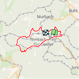

Length
11.7 km

Max alt
972 m

Uphill gradient
485 m
Km-Effort
18.1 km

Min alt
537 m

Downhill gradient
481 m
Boucle
Yes
Creation date :
2014-12-10 00:00:00.0
Updated on :
2014-12-10 00:00:00.0
3h30
Difficulty : Easy

FREE GPS app for hiking
 SityTrail
IGN / Geographical institutes
SityTrail Plus
The world is yours!
About
Trail Walking of 11.7 km to be discovered at Grand Est, Haut-Rhin, Soultz-Haut-Rhin. This trail is proposed by davidl03.
Description
Suivre le balisage "Rouge-blanc-rouge"
Tracé plus difficile dans le sens inverse
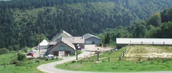
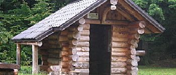
Photos


Positioning
Country:
France
Region :
Grand Est
Department/Province :
Haut-Rhin
Municipality :
Soultz-Haut-Rhin
Location:
Unknown
Start:(Dec)
Start:(UTM)
362710 ; 5307497 (32T) N.
Comments