Trail Mountain bike Toul - Côtes de Toul 50k 2012 - Photo

Côtes de Toul 50k 2012

© OpenStreetMap contributors
Length
Length
59 km
Max alt
Max alt
404 m
Uphill gradient
Uphill gradient
1163 m
Km-Effort
Km-Effort  
75 km
Min alt
Min alt
204 m
Downhill gradient
Downhill gradient
1163 m
Boucle
Boucle
Yes
Creation date :
2014-12-10 00:00:00.0
Updated on :
2014-12-10 00:00:00.0

(2 Reviews)

Mountain bike
Mountain bike
5h15
Difficulty : Difficult

Scan this QR Code to open this trail in the SityTrail application

FREE GPS app for hiking

Logo SityTrail SityTrail

IGN / Geographical institutes

Download SityTrail from the App Store Download SityTrail from Google Play

Logo SityTrail SityTrail World

The world is yours!

Download SityTrail from the App Store Download SityTrail from Google Play Download SityTrail on Huawei AppGallery

About

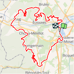
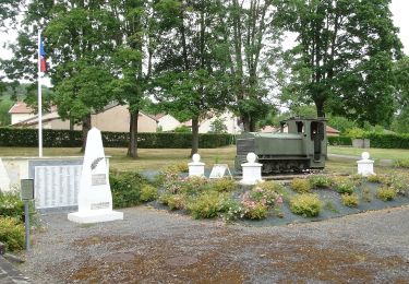
Trail Mountain bike of 59 km to be discovered at Grand Est, Meurthe-et-Moselle, Toul. This trail is proposed by virginieHurpeau.

Description

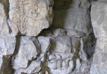
Trés belle rando avec de tout beaucoup et deux fois réalisé dans le sens antihoraire...à refaire

Elevation profile

Positioning

Country:
France
Region :
Grand Est
Department/Province :
Meurthe-et-Moselle
Municipality :
Toul
Location:
Unknown
Start:(UTM)
712654 ; 5394094 (31U) N.

Comments

Please log in to post a review or rate the element


Beau circuit


Trails nearby

Trail On foot Bruley - Circuit de la Petite Linotte - Photo
On foot
PRO

On foot

Easy
Bruley, Grand Est, Meurthe-et-Moselle, France
9.2 km | 12 km-effort
2h 43min
No
Trail Mountain bike Écrouves - 1 ère rando VTT - Photo
Mountain bike
ericsnoopy

Mountain bike

Very easy
(1)
Écrouves, Grand Est, Meurthe-et-Moselle, France
7.5 km | 9.5 km-effort
Unknown
Yes
Trail On foot Choloy-Ménillot - Boucle des Sources - Photo
On foot
PRO

On foot

Easy
Choloy-Ménillot, Grand Est, Meurthe-et-Moselle, France
10.4 km | 11.9 km-effort
2h 42min
No
Trail On foot Dommartin-lès-Toul - Circuit du Luxembourg - Photo
On foot
PRO

On foot

Easy
Dommartin-lès-Toul, Grand Est, Meurthe-et-Moselle, France
12.5 km | 15.3 km-effort
3h 28min
No
Trail On foot Pagney-derrière-Barine - Circuit du Val des Nonnes - Photo
On foot
PRO

On foot

Easy
Pagney-derrière-Barine, Grand Est, Meurthe-et-Moselle, France
14.9 km | 19 km-effort
4h 19min
Yes
Trail On foot Chaudeney-sur-Moselle - Circuit du Bois Gaillard - Photo
On foot
PRO

On foot

Easy
Chaudeney-sur-Moselle, Grand Est, Meurthe-et-Moselle, France
6.6 km | 7.5 km-effort
1h 42min
Yes
Trail On foot Écrouves - Sentier Toul-Thiaucourt - Photo
On foot
PRO

On foot

Medium
Écrouves, Grand Est, Meurthe-et-Moselle, France
22 km | 24 km-effort
5h 28min
No
Trail On foot Écrouves - Chemin des Chanottes - Photo
On foot
PRO

On foot

Easy
Écrouves, Grand Est, Meurthe-et-Moselle, France
5.6 km | 6.4 km-effort
1h 27min
No
Trail Walking Bruley - Bruley Lucey - Photo
Walking
papounet56

Walking

Easy
Bruley, Grand Est, Meurthe-et-Moselle, France
10.2 km | 13.2 km-effort
3h 41min
Yes


Close
My subscriptions