


7.8 km | 10.1 km-effort

User


FREE GPS app for hiking
 SityTrail
IGN / Geographical institutes
SityTrail World
The world is yours!
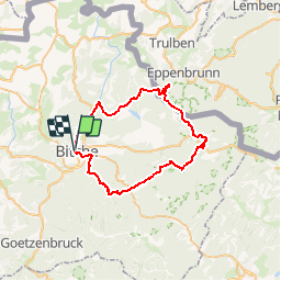
Trail Walking of 44 km to be discovered at Grand Est, Moselle, Bitche. This trail is proposed by tracegps.
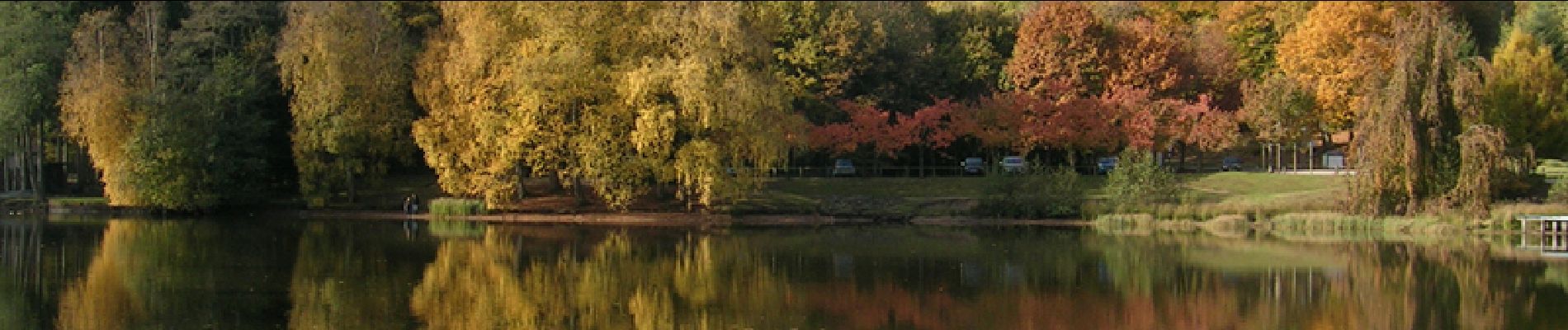
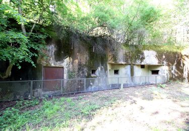
Départ : Bitche, Place Robert Schuman, Chapelle de l’Etang. Descriptif: randonnée autour du camp militaire de Bitche (balisage réalisé et entretenu par le Club Vosgien) Quitter le parking, balisage croix jaune. Rue de la Poste (voir la synagogue). Rue des Acacias. Moulin de Ramstein. Ochsenmuehle. Après la Schwingmuehle, le chemin quitte la vallée de la Horn par un large virage à droite, km5,4. Continuer à suivre le balisage croix jaune jusqu’au carrefour du Schlossberg km7,5. Quitter le chemin balisé, continuer tout droit et descendre vers Haspelschiedt, chemin empierré direction Nord-Est. Rue de la Paix. Cimetière. Avant l’église, tourner à gauche rue Hohl. Traverser le Schwarzbach, km9. Suivre de nouveau le balisage croix jaune, monter à gauche rue du Muhlenberg. Au centre de Roppeviller, tourner à droite. A la frontière allemande km13.1, tourner à droite et suivre le balisage allemand rectangle bleu et blanc. Après 500m, passer au pied du Altschloßfelsen, 1500 m de long. Longer camp militaire de Bitche. A partir du Zollstock, km18.8, suivre croix jaune. Carrefour du Eichenberg, km22,3. Suivre le disque rouge jusqu’à Sturzelbronn, km23,6. 200m après l’abbaye, tourner à droite sur anneau vert et gravir le sentier en lacets. Arrivé en haut (km24,1), tourner à droite sur le chemin forestier non balisé. Après un large virage à gauche, continuer direction Sud-Ouest, en longeant les parcelles ONF n° 87 puis 92, avec pente vers vallon à main droite. Au col de la Rondelle, km26, poursuivre tout droit sur rectangle jaune jusqu’au Erbsenweiher (km27,4). Tourner à droite sur le losange jaune jusqu’à la maison forestière de Biesenberg km28,5. Quitter le chemin balisé, tourner à gauche et rester sur la « Route Forestière Noire » jusqu’au carrefour suivant, km30,4. A ce carrefour, vous retrouvez le losange jaune que vous ne quittez plus jusqu’à l’arrivée. Les étapes suivantes sont : le lavoir d’Eguelshardt km33.6, la maison forestière Hochkopf km37, l’étang de Hasselfurth km 40, la station de pompage de Bitche km42,195 (Marathon), la traversée du Parc du Stadtweiher et l’arrivée. A Struzelbronn, possibilité d’y passer la nuit. Sinon, revenir à Bitche en voiture individuelle ou en taxi (14 km sur D35). Cette description est le circuit n°2 du topoguide édité par l’association Club Vosgien de Bitche « Balades dans le Pays de Bitche », également disponible en allemand sous le titre „Wanderungen im Bitcherland“. D’autres infos sur le site du club vosgien de Bitche.


Walking

Walking
On foot
On foot
On foot