Trail Walking Gouézec - Carreck an Tan - Gouézec - Photo

Carreck an Tan - Gouézec

 tracegps
tracegps

User

© OpenStreetMap contributors
Length
Length
17.3 km
Max alt
Max alt
268 m
Uphill gradient
Uphill gradient
336 m
Km-Effort
Km-Effort  
22 km
Min alt
Min alt
22 m
Downhill gradient
Downhill gradient
338 m
Boucle
Boucle
Yes
Creation date :
2014-12-10 00:00:00.0
Updated on :
2014-12-10 00:00:00.0

(1 Reviews)

Walking
Walking
3h00
Difficulty : Medium

Scan this QR Code to open this trail in the SityTrail application

FREE GPS app for hiking

Logo SityTrail SityTrail

IGN / Geographical institutes

Download SityTrail from the App Store Download SityTrail from Google Play

Logo SityTrail SityTrail World

The world is yours!

Download SityTrail from the App Store Download SityTrail from Google Play Download SityTrail on Huawei AppGallery

About

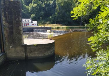
Trail Walking of 17.3 km to be discovered at Brittany, Finistère, Gouézec. This trail is proposed by tracegps.

Description

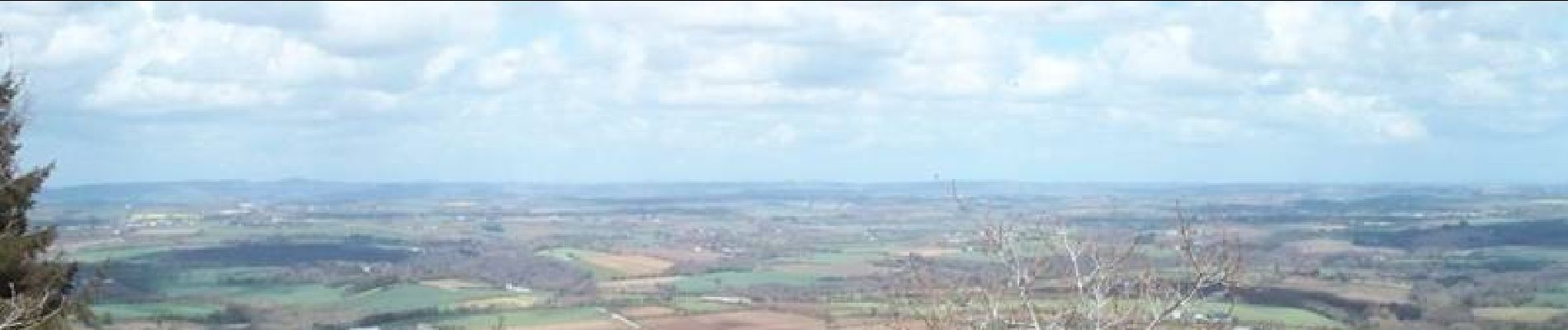
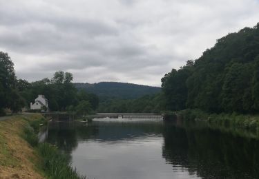
Départ parking de l'église de Gouézec, prendre le sentier qui monte à l'angle de la place, panneau La Roche du Feu, et en suivant chemins creux et sentiers forestier, rejoindre le sommet. Superbe panorama à 360°, puis descendre en direction du canal de Nantes à Brest, en passant par Raouennic, Croaz Toull, Le Boulen, Bourligou. Traverser le L'Aulne à Ty Men, et suivant le cours du fleuve, gagner Pont-Coblanc. Suivre alors les panneaux circuit de Pont-Coblanc, et regagner le parking.

Elevation profile

Photos

Positioning

Country:
France
Region :
Brittany
Department/Province :
Finistère
Municipality :
Gouézec
Location:
Unknown
Start:(UTM)
427590 ; 5335568 (30U) N.

Comments

Please log in to post a review or rate the element


Trails nearby

Trail Walking Gouézec - Circuit du pont Coblant - Gouézec - Photo
Walking
tracegps

Walking

Medium
Gouézec, Brittany, Finistère, France
11.6 km | 13.9 km-effort
3h 0min
Yes
Trail Walking Pleyben - pont coblant - Photo
Walking
Magali BAHUON

Walking

Easy
Pleyben, Brittany, Finistère, France
3.1 km | 3.3 km-effort
56min
No
Trail Walking Pleyben - Pont Coblan à Gouézec et les rives de l'Aulne - Photo
Walking
tracegps

Walking

Difficult
Pleyben, Brittany, Finistère, France
20 km | 26 km-effort
4h 0min
Yes
Trail Hybrid bike Pleyben - Pont Comblanc Port Carhaix - Photo
Hybrid bike
Roulland

Hybrid bike

Easy
Pleyben, Brittany, Finistère, France
61 km | 72 km-effort
3h 27min
No
Trail Walking Lothey - Le circuit de l'Aulne 08-07-2019 - Photo
Walking
jmrobin

Walking

Easy
Lothey, Brittany, Finistère, France
12.9 km | 15.4 km-effort
3h 14min
Yes
Trail Walking Gouézec - Pont Coblant - Photo
Walking
poupartbertrand

Walking

Easy
Gouézec, Brittany, Finistère, France
10 km | 11.8 km-effort
2h 9min
No
Trail Walking Edern - éden s'y Symphorien - Photo
Walking
kurun

Walking

Very easy
Edern, Brittany, Finistère, France
8.4 km | 10.6 km-effort
1h 55min
Yes
Trail Walking Lothey - lothey - Photo
Walking
Youndarts

Walking

Difficult
Lothey, Brittany, Finistère, France
13 km | 16 km-effort
2h 36min
Yes
Trail Walking Gouézec - Canal Nantes/Brest à Lennon - Photo
Walking
Yvanno

Walking

Very easy
Gouézec, Brittany, Finistère, France
10.2 km | 12.1 km-effort
2h 32min
Yes


Close
My subscriptions