Trail Mountain bike Belsentes - St Julien Boutières - La Gare- Le Cheylard - Photo

St Julien Boutières - La Gare- Le Cheylard

 tracegps
tracegps

User

© OpenStreetMap contributors
Length
Length
35 km
Max alt
Max alt
693 m
Uphill gradient
Uphill gradient
594 m
Km-Effort
Km-Effort  
43 km
Min alt
Min alt
399 m
Downhill gradient
Downhill gradient
590 m
Boucle
Boucle
Yes
Creation date :
2014-12-10 00:00:00.0
Updated on :
2014-12-10 00:00:00.0

(0 Reviews)

Mountain bike
Mountain bike
2h30
Difficulty : Medium

Scan this QR Code to open this trail in the SityTrail application

FREE GPS app for hiking

Logo SityTrail SityTrail

IGN / Geographical institutes

Download SityTrail from the App Store Download SityTrail from Google Play

Logo SityTrail SityTrail World

The world is yours!

Download SityTrail from the App Store Download SityTrail from Google Play Download SityTrail on Huawei AppGallery

About

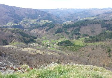
Trail Mountain bike of 35 km to be discovered at Auvergne-Rhône-Alpes, Ardèche, Belsentes. This trail is proposed by tracegps.

Description

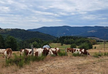
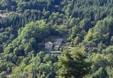
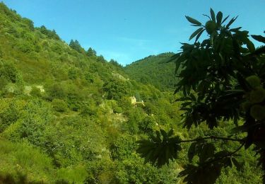
Aller- retour sur l'ancienne voie ferrée. Tronçon de 35km caillouteux sur 3km et très roulant sur la partie basse. Le parcours longe la belle vallée de l'Eyrieux. On pourra prolonger jusqu'à St Agrève en amont mais la piste est alors moins roulante et emprunte trois tunnels.

Elevation profile

Photos

Positioning

Country:
France
Region :
Auvergne-Rhône-Alpes
Department/Province :
Ardèche
Municipality :
Belsentes
Location:
Nonières
Start:(UTM)
616864 ; 4973501 (31T) N.

Trails nearby

Trail Walking Belsentes - Autour de la Chazalet  - Photo
Walking
GUIDE
nadinebondoux

Walking

Easy
(1)
Belsentes, Auvergne-Rhône-Alpes, Ardèche, France
8.1 km | 11.5 km-effort
2h 18min
Yes
Trail Walking Saint-Jean-Chambre - Boucle Chalencon Pont de Chervil - Photo
Walking
GUIDE
nadinebondoux

Walking

Difficult
Saint-Jean-Chambre, Auvergne-Rhône-Alpes, Ardèche, France
15.9 km | 24 km-effort
5h 42min
Yes
Trail Walking Belsentes - Saint-julien-labrousse 1er mai la rando des chanteurs de mai - Photo
Walking
bernadette revoux

Walking

Medium
Belsentes, Auvergne-Rhône-Alpes, Ardèche, France
20 km | 30 km-effort
4h 35min
No
Trail Walking Belsentes - Nonières. Par les chemins de l'école Buisson-nière - Photo
Walking
bernadette revoux

Walking

Medium
Belsentes, Auvergne-Rhône-Alpes, Ardèche, France
8.6 km | 14.2 km-effort
3h 20min
Yes
Trail Walking Le Cheylard - Randonnée Le cheylard - Saint-Agrève - Lac Devesset - Photo
Walking
voyageur_nature

Walking

Medium
(2)
Le Cheylard, Auvergne-Rhône-Alpes, Ardèche, France
34 km | 45 km-effort
9h 55min
No
Trail Walking Le Cheylard - Le Cheylard -> Saint Martin de Valamas - Photo
Walking
voyageur_nature

Walking

Very easy
Le Cheylard, Auvergne-Rhône-Alpes, Ardèche, France
17.4 km | 22 km-effort
5h 9min
Yes
Trail Walking Chalencon - Les trois V  - Le Pont de Chervil  - Photo
Walking
tracegps

Walking

Difficult
Chalencon, Auvergne-Rhône-Alpes, Ardèche, France
9.6 km | 15.6 km-effort
2h 30min
Yes
Trail Running Le Cheylard - la glorie rocher de brion - Photo
Running
olivier4307

Running

Difficult
Le Cheylard, Auvergne-Rhône-Alpes, Ardèche, France
8 km | 12.6 km-effort
1h 7min
Yes
Trail Road bike Saint-Prix - 07 vélo st agreve Cheylard desaigne - Photo
Road bike
himba26100

Road bike

Medium
Saint-Prix, Auvergne-Rhône-Alpes, Ardèche, France
66 km | 87 km-effort
6h 53min
Yes


Close
My subscriptions