


Beaugeay-Pont interdit

Bobol
User

Length
29 km

Max alt
20 m

Uphill gradient
147 m
Km-Effort
31 km

Min alt
-2 m

Downhill gradient
144 m
Boucle
Yes
Creation date :
2014-12-10 00:00:00.0
Updated on :
2014-12-10 00:00:00.0
1h51
Difficulty : Easy

FREE GPS app for hiking
 SityTrail
IGN / Geographical institutes
SityTrail Plus
The world is yours!
About
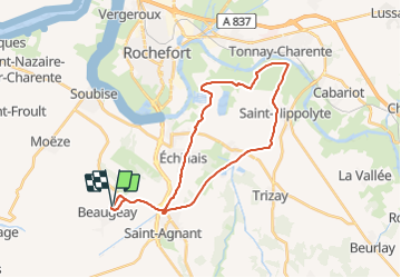
Trail Cycle of 29 km to be discovered at New Aquitaine, Charente-Maritime, Beaugeay. This trail is proposed by Bobol.
Positioning
Country:
France
Region :
New Aquitaine
Department/Province :
Charente-Maritime
Municipality :
Beaugeay
Location:
Unknown
Start:(Dec)
Start:(UTM)
655516 ; 5082407 (30T) N.
Comments