Trail Cycle Bonnevent-Velloreille - Bonnevent Gy - Photo
 jp360
jp360

User

© OpenStreetMap contributors
Length
Length
32 km
Max alt
Max alt
372 m
Uphill gradient
Uphill gradient
591 m
Km-Effort
Km-Effort  
40 km
Min alt
Min alt
212 m
Downhill gradient
Downhill gradient
583 m
Boucle
Boucle
No
Creation date :
2014-12-10 00:00:00.0
Updated on :
2014-12-10 00:00:00.0

(0 Reviews)

Cycle
Cycle
--
Difficulty : Easy

Scan this QR Code to open this trail in the SityTrail application

FREE GPS app for hiking

Logo SityTrail SityTrail

IGN / Geographical institutes

Download SityTrail from the App Store Download SityTrail from Google Play

Logo SityTrail SityTrail World

The world is yours!

Download SityTrail from the App Store Download SityTrail from Google Play Download SityTrail on Huawei AppGallery

About

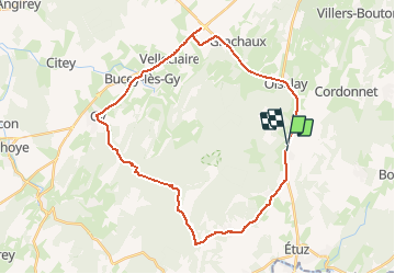
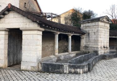
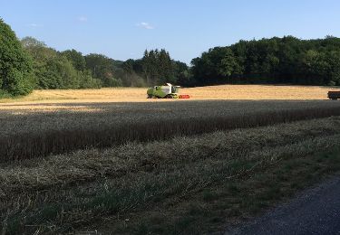
Trail Cycle of 32 km to be discovered at Bourgogne-Franche-Comté, Haute-Saône, Bonnevent-Velloreille. This trail is proposed by jp360.

Description

Boucle autour des monts de GY

Elevation profile

Positioning

Country:
France
Region :
Bourgogne-Franche-Comté
Department/Province :
Haute-Saône
Municipality :
Bonnevent-Velloreille
Location:
Unknown
Start:(UTM)
721362 ; 5252897 (31T) N.

Trails nearby

Trail Walking Boulot - Circuit des hauts du Mont - Boulot - Photo
Walking
tracegps

Walking

Medium
Boulot, Bourgogne-Franche-Comté, Haute-Saône, France
7.9 km | 9.9 km-effort
2h 30min
Yes
Trail Mountain bike Montboillon - Espace VTT FFC des Monts de Gy - Circuit de Vauvenise - n° 59 - Photo
Mountain bike
tracegps

Mountain bike

Difficult
Montboillon, Bourgogne-Franche-Comté, Haute-Saône, France
21 km | 26 km-effort
1h 40min
Yes
Trail Walking Étuz - étuz  - Photo
Walking
MartinBraudThierry

Walking

Difficult
Étuz, Bourgogne-Franche-Comté, Haute-Saône, France
11.7 km | 14.1 km-effort
2h 59min
Yes
Trail Walking Gézier-et-Fontenelay - rando gezier - Photo
Walking
mig26

Walking

Easy
Gézier-et-Fontenelay, Bourgogne-Franche-Comté, Haute-Saône, France
18.3 km | 24 km-effort
4h 18min
Yes
Trail Walking Boult - Boult petite randonnée  - Photo
Walking
nicolasdresse

Walking

Boult, Bourgogne-Franche-Comté, Haute-Saône, France
7.4 km | 8.9 km-effort
2h 0min
Yes
Trail Walking Montarlot-lès-Rioz - montarlot les rioz - Photo
Walking
nicolasdresse

Walking

Easy
Montarlot-lès-Rioz, Bourgogne-Franche-Comté, Haute-Saône, France
7.9 km | 10.1 km-effort
2h 12min
Yes
Trail Walking Montarlot-lès-Rioz - monterait les rioz - Photo
Walking
paillyclaude

Walking

Medium
Montarlot-lès-Rioz, Bourgogne-Franche-Comté, Haute-Saône, France
9.9 km | 12.7 km-effort
2h 42min
Yes
Trail Walking Montboillon - montboillon - Photo
Walking
paillyclaude

Walking

Medium
Montboillon, Bourgogne-Franche-Comté, Haute-Saône, France
17 km | 22 km-effort
5h 34min
Yes
Trail Walking Boulot - boulot chaux la graviolle - Photo
Walking
paillyclaude

Walking

Easy
Boulot, Bourgogne-Franche-Comté, Haute-Saône, France
9.6 km | 11.2 km-effort
2h 44min
Yes


Close
My subscriptions