


Tour du lac du diable

xav34830
User
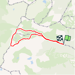

Length
12.8 km

Max alt
2589 m

Uphill gradient
986 m
Km-Effort
26 km

Min alt
1648 m

Downhill gradient
986 m
Boucle
Yes
Creation date :
2014-12-10 00:00:00.0
Updated on :
2014-12-10 00:00:00.0
--
Difficulty : Medium

FREE GPS app for hiking
 SityTrail
IGN / Geographical institutes
SityTrail Plus
The world is yours!
About
Trail Walking of 12.8 km to be discovered at Occitania, Pyrénées-Orientales, Fontrabiouse. This trail is proposed by xav34830.
Positioning
Country:
France
Region :
Occitania
Department/Province :
Pyrénées-Orientales
Municipality :
Fontrabiouse
Location:
Unknown
Start:(Dec)
Start:(UTM)
421893 ; 4720933 (31T) N.
Comments
Très bonne application