


GR TMB 06

mazelpat
User
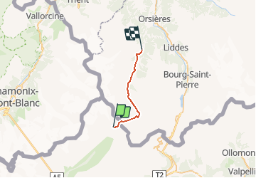

Length
16.7 km

Max alt
2537 m

Uphill gradient
665 m
Km-Effort
29 km

Min alt
1185 m

Downhill gradient
1545 m
Boucle
No
Creation date :
2016-03-09 00:00:00.0
Updated on :
2016-03-09 00:00:00.0
--
Difficulty : Unknown

FREE GPS app for hiking
 SityTrail
IGN / Geographical institutes
SityTrail Plus
The world is yours!
About
Trail Other activity of 16.7 km to be discovered at Aosta Valley, Unknown, Courmayeur. This trail is proposed by mazelpat.
Description
Etape 6 : Refuge Elena - Praz de fort
Positioning
Country:
Italy
Region :
Aosta Valley
Department/Province :
Unknown
Municipality :
Courmayeur
Location:
Unknown
Start:(Dec)
Start:(UTM)
349990 ; 5083098 (32T) N.
Comments