


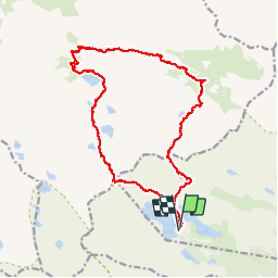

16.2 km | 31 km-effort


User


FREE GPS app for hiking
 SityTrail
IGN / Geographical institutes
SityTrail World
The world is yours!
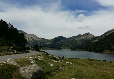
Trail Walking of 24 km to be discovered at Occitania, Hautespyrenees, Vielle-Aure. This trail is proposed by cfo92130.
Rando effectuée en Aout 2012, à partir du parking du Lac d'Aubert.
C'est une boucle assez longue, nous l'avons effectuée en 10h dont 8h de marche.
A l'aller, nous sommes passés par la Hourquete d'Aubert. Et, au retour, par le Col de Madamète.
PS: La route qui monte au parking est fermée à la circulation entre 9h30 et 18h00
Walking

Walking

Walking

Walking

Walking
Walking
Walking

Walking
Walking