Trail Walking Barèges - Refuge de Glère brèche de Chaussenque Pic de Neouvielle, lac d'Oredon - Photo

Refuge de Glère brèche de Chaussenque Pic de Neouvielle, lac d'Oredon

© OpenStreetMap contributors
Length
Length
16.2 km
Max alt
Max alt
3051 m
Uphill gradient
Uphill gradient
1005 m
Km-Effort
Km-Effort  
31 km
Min alt
Min alt
1850 m
Downhill gradient
Downhill gradient
1266 m
Boucle
Boucle
No
Creation date :
2016-08-26 00:00:00.0
Updated on :
2016-08-26 00:00:00.0

(1 Reviews)

Walking
Walking
5h58
Difficulty : Difficult

Scan this QR Code to open this trail in the SityTrail application

FREE GPS app for hiking

Logo SityTrail SityTrail

IGN / Geographical institutes

Download SityTrail from the App Store Download SityTrail from Google Play

Logo SityTrail SityTrail World

The world is yours!

Download SityTrail from the App Store Download SityTrail from Google Play Download SityTrail on Huawei AppGallery

About

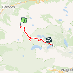
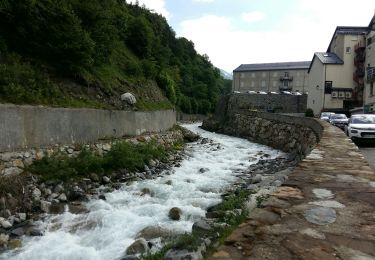
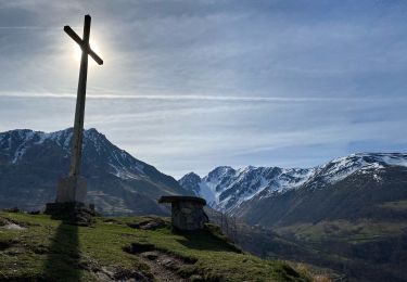
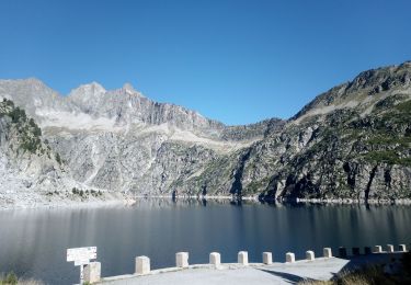
Trail Walking of 16.2 km to be discovered at Occitania, Hautespyrenees, Barèges. This trail is proposed by reneperrin.

Description

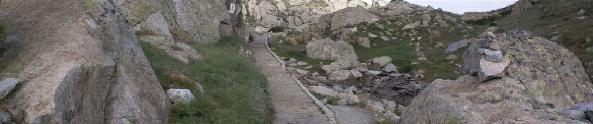
Traversée assez technique, brèche de Chaussenque avec éboulis et roches instables, de long névés vers le Neouvielle

Elevation profile

Photos

Positioning

Country:
France
Region :
Occitania
Department/Province :
Hautespyrenees
Municipality :
Barèges
Location:
Unknown
Start:(UTM)
262325 ; 4749470 (31T) N.

Comments

Please log in to post a review or rate the element


Trails nearby

Trail Walking Barèges - Pic des Trois Conseillers - Photo
Walking
tracegps

Walking

Very difficult
(1)
Barèges, Occitania, Hautespyrenees, France
16 km | 34 km-effort
9h 0min
Yes
Trail Walking Aragnouet - Pic d'Estaragne et Pic Cambieil - Photo
Walking
tracegps

Walking

Very difficult
(2)
Aragnouet, Occitania, Hautespyrenees, France
11.6 km | 28 km-effort
3h 40min
Yes
Trail Walking Barèges - Pic de Madamète en boucle par les lacs - Photo
Walking
tracegps

Walking

Difficult
(1)
Barèges, Occitania, Hautespyrenees, France
21 km | 40 km-effort
9h 0min
Yes
Trail Walking Barèges - BAREGES le tour des plateaux G4 reco  3264577 - Photo
Walking
GUIDE
marmotte65

Walking

Medium
Barèges, Occitania, Hautespyrenees, France
7.2 km | 11 km-effort
2h 4min
Yes
Trail Walking Barèges - En boucle, Grand Tourmalet- Aygues Cluses-Col de Madamète- Lac  Dets Coubous. - Photo
Walking
2034

Walking

Difficult
(3)
Barèges, Occitania, Hautespyrenees, France
16.7 km | 32 km-effort
6h 26min
Yes
Trail Walking Barèges - Bareges St Justin - Photo
Walking
GUIDE
antignacs

Walking

Very easy
Barèges, Occitania, Hautespyrenees, France
5.2 km | 6.9 km-effort
1h 38min
Yes
Trail Walking Betpouey - Betpouey - Photo
Walking
GUIDE
antignacs

Walking

Medium
Betpouey, Occitania, Hautespyrenees, France
15.6 km | 25 km-effort
5h 10min
Yes
Trail Walking Aragnouet - 2023-09-08 Lacs Neouvielle - Photo
Walking
Mich&Agnès

Walking

Difficult
Aragnouet, Occitania, Hautespyrenees, France
13.9 km | 24 km-effort
5h 55min
Yes
Trail Walking Sers - BAREGES G4 le tour des plateaux
Walking
GUIDE
marmotte65

Walking

Medium
Sers, Occitania, Hautespyrenees, France
7.1 km | 11 km-effort
2h 9min
Yes


Close
My subscriptions