Trail Walking Vaufrey - Vallée du Doubs entre Vaufrey et Premoncourt - Photo

Vallée du Doubs entre Vaufrey et Premoncourt

 ballet
ballet

User

© OpenStreetMap contributors
Length
Length
27 km
Max alt
Max alt
760 m
Uphill gradient
Uphill gradient
876 m
Km-Effort
Km-Effort  
39 km
Min alt
Min alt
397 m
Downhill gradient
Downhill gradient
872 m
Boucle
Boucle
Yes
Creation date :
2014-12-10 00:00:00.0
Updated on :
2014-12-10 00:00:00.0

(0 Reviews)

Walking
Walking
6h40
Difficulty : Difficult

Scan this QR Code to open this trail in the SityTrail application

FREE GPS app for hiking

Logo SityTrail SityTrail

IGN / Geographical institutes

Download SityTrail from the App Store Download SityTrail from Google Play

Logo SityTrail SityTrail World

The world is yours!

Download SityTrail from the App Store Download SityTrail from Google Play Download SityTrail on Huawei AppGallery

About

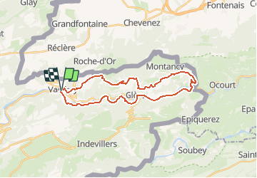
Trail Walking of 27 km to be discovered at Bourgogne-Franche-Comté, Doubs, Vaufrey. This trail is proposed by ballet.

Description

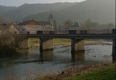
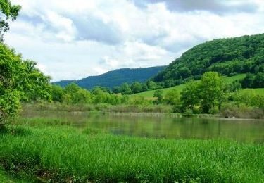
Pour les amoureux du Doubs
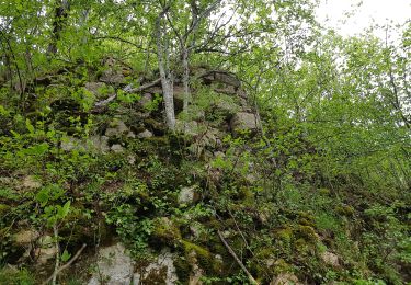
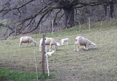
Balade d'une bonne longueur et avec un fort dénivellé cumulé. Au fil des contours reliefs du reliefs puis des méandres du Doubs vous découvrez des paysages sauvages entre hameaux, forêts profondes et eau

Elevation profile

Positioning

Country:
France
Region :
Bourgogne-Franche-Comté
Department/Province :
Doubs
Municipality :
Vaufrey
Location:
Unknown
Start:(UTM)
343118 ; 5245808 (32T) N.

Trails nearby

Trail On foot Haute-Ajoie - Tour de Faux d'Enson - fixme - Photo
On foot
PRO

On foot

Easy
Haute-Ajoie, Jura, District de Porrentruy, Switzerland
4.5 km | 6.1 km-effort
1h 22min
No
Trail On foot Haute-Ajoie - Tour de Faux d'Enson - Rocourt - Photo
On foot
PRO

On foot

Easy
Haute-Ajoie, Jura, District de Porrentruy, Switzerland
5.3 km | 7 km-effort
1h 36min
No
Trail Walking Haute-Ajoie - Circuit des fermes 26-03-17 - Photo
Walking
juliogomez

Walking

Easy
Haute-Ajoie, Jura, District de Porrentruy, Switzerland
11.6 km | 18.3 km-effort
4h 7min
Yes
Trail Walking Villars-lès-Blamont - Sappois  - Photo
Walking
juliogomez

Walking

Medium
Villars-lès-Blamont, Bourgogne-Franche-Comté, Doubs, France
15.7 km | 23 km-effort
5h 15min
Yes
Trail Walking Soulce-Cernay - la grotte - Photo
Walking
banzai25200

Walking

Medium
Soulce-Cernay, Bourgogne-Franche-Comté, Doubs, France
6.6 km | 11.1 km-effort
2h 24min
Yes
Trail Walking Haute-Ajoie - Sur les Monts du Lomont 2/2 - De Montavon à Montécheroux, par Vaufrey et la Borne 452 - Photo
Walking
tracegps

Walking

Difficult
Haute-Ajoie, Jura, District de Porrentruy, Switzerland
21 km | 32 km-effort
6h 0min
No
Trail Walking Vaufrey - Le Circuit des Fermes - Doubs - Photo
Walking
tracegps

Walking

Difficult
Vaufrey, Bourgogne-Franche-Comté, Doubs, France
11.2 km | 17.6 km-effort
4h 0min
Yes
Trail Walking Haute-Ajoie - Ajoie - unbekanntes Grenzland zu Frankreich - Photo
Walking
GUIDE+

Walking

Very easy
(1)
Haute-Ajoie, Jura, District de Porrentruy, Switzerland
14.3 km | 19.6 km-effort
6h 54min
No
Trail Walking Vaufrey - vaufrey - Photo
Walking
gerard70

Walking

Easy
Vaufrey, Bourgogne-Franche-Comté, Doubs, France
23 km | 35 km-effort
5h 35min
Yes


Close
My subscriptions