


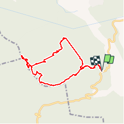


8.5 km | 14.4 km-effort


User


FREE GPS app for hiking
 SityTrail
IGN / Geographical institutes
SityTrail World
The world is yours!
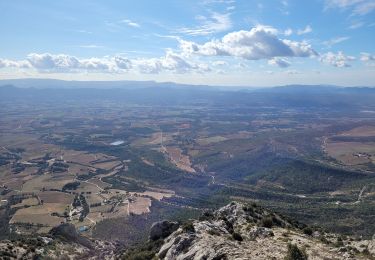
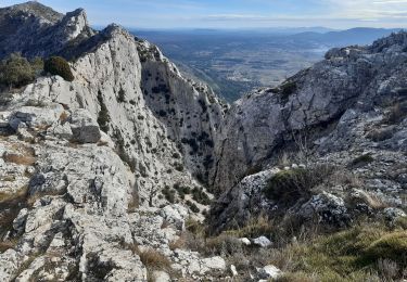
Trail Walking of 8.8 km to be discovered at Provence-Alpes-Côte d'Azur, Bouches-du-Rhône, Jouques. This trail is proposed by Spinnaker.
Dans la montée du vallon du Pié de Masse on peut voir deux vieux fourneaux d'anciennes charbonnières. La remontée de ce vallon est d'ailleurs superbe!

Walking
Walking
Walking
Walking
Walking
Walking

Walking
Trail
Walking