


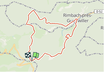
FIRSTACKER - RIMBACH

patrickbeyrath
User


3h22
Difficulty : Medium

FREE GPS app for hiking
 SityTrail
IGN / Geographical institutes
SityTrail Plus
The world is yours!
About
Trail Walking of 9.2 km to be discovered at Grand Est, Haut-Rhin, Soultz-Haut-Rhin. This trail is proposed by patrickbeyrath.
Description
P Firstacker - prendre triangle rouge Glashutte - triangle bleu vers Col du judenhut - prendre rect.rouge-blanc-rouge vers Rimbach - reprendre triangle rouge et rejoindre rect.rouge - blanc - rougele Sudel et retour Firstacker
Positioning
Comments