


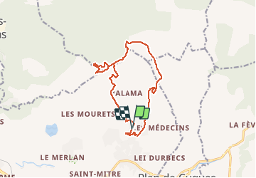

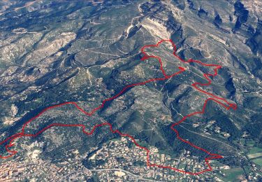
9.2 km | 15.2 km-effort


User GUIDE


FREE GPS app for hiking
 SityTrail
IGN / Geographical institutes
SityTrail World
The world is yours!
Trail Walking of 15.4 km to be discovered at Provence-Alpes-Côte d'Azur, Bouches-du-Rhône, Marseille. This trail is proposed by lhomme.ph.
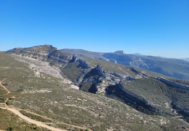
Une montée pour dominer Marseille et les massifs environnants.
(Noter une difficulté sur la crête avant d'arriver à l'Etoile que l'on peut éviter en restant sur la piste qui mène aux installations.)


Walking

Walking

Mountain bike
Walking
Walking
Walking
Walking
Walking
Walking