


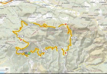
25 km | 36 km-effort


User


FREE GPS app for hiking
 SityTrail
IGN / Geographical institutes
SityTrail World
The world is yours!
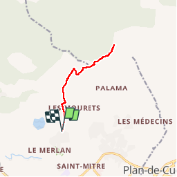
Trail Walking of 10.7 km to be discovered at Provence-Alpes-Côte d'Azur, Bouches-du-Rhône, Marseille. This trail is proposed by Spinnaker.

Mountain bike

Walking

Walking

Walking

Walking

Mountain bike
Walking

Walking
Mountain bike
Très bonne appli. j ai telecharge mon choix de carte. et donc les ai a disposirion Hors Connexion J ai des loupés sur certaines dalles.... mauvaise wifi ? ou bug de l application ?