


Aire de Monnières - La Foulotière

albert39
User

Length
9.3 km

Max alt
346 m

Uphill gradient
214 m
Km-Effort
12.2 km

Min alt
215 m

Downhill gradient
214 m
Boucle
Yes
Creation date :
2014-12-10 00:00:00.0
Updated on :
2014-12-10 00:00:00.0
1h52
Difficulty : Easy

FREE GPS app for hiking
 SityTrail
IGN / Geographical institutes
SityTrail Plus
The world is yours!
About
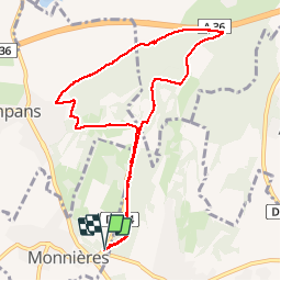
Trail Nordic walking of 9.3 km to be discovered at Bourgogne-Franche-Comté, Jura, Monnières. This trail is proposed by albert39.
Description
Départ parking de Monnières, librairie, descente par la côte 295 sur Sampans, Source de la Foulotière, retour par la carrière et Sanctuaire.
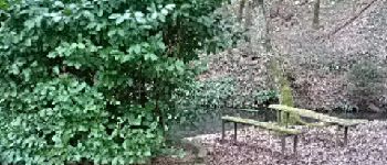
Photos


Positioning
Country:
France
Region :
Bourgogne-Franche-Comté
Department/Province :
Jura
Municipality :
Monnières
Location:
Unknown
Start:(Dec)
Start:(UTM)
687339 ; 5220546 (31T) N.
Comments