Trail Walking Croixdalle - Circuit de Croixdalle - Photo

Circuit de Croixdalle

 tracegps
tracegps

User

© OpenStreetMap contributors
Length
Length
16.4 km
Max alt
Max alt
221 m
Uphill gradient
Uphill gradient
331 m
Km-Effort
Km-Effort  
21 km
Min alt
Min alt
67 m
Downhill gradient
Downhill gradient
331 m
Boucle
Boucle
Yes
Creation date :
2014-12-10 00:00:00.0
Updated on :
2014-12-10 00:00:00.0

(0 Reviews)

Walking
Walking
4h04
Difficulty : Very difficult

Scan this QR Code to open this trail in the SityTrail application

FREE GPS app for hiking

Logo SityTrail SityTrail

IGN / Geographical institutes

Download SityTrail from the App Store Download SityTrail from Google Play

Logo SityTrail SityTrail World

The world is yours!

Download SityTrail from the App Store Download SityTrail from Google Play Download SityTrail on Huawei AppGallery

About

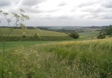
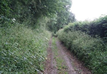
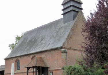
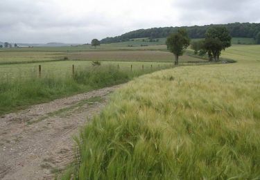
Trail Walking of 16.4 km to be discovered at Normandy, Seine-Maritime, Croixdalle. This trail is proposed by tracegps.

Description

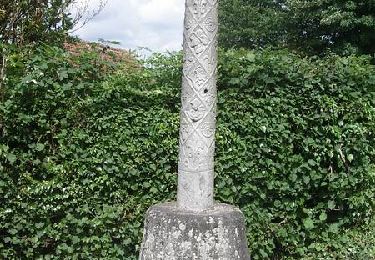
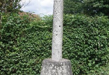
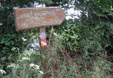
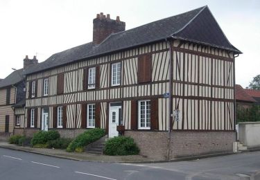
Circuit proposé par le syndicat d'initiative de Londinières. Départ de la mairie de Croixdalle. La forêt du Hellet couvre une partie importante de la commune. Au hameau « la verrerie du hellet », se trouvait une verrerie où ètaient fabriquées des bouteilles du XVIIème au début du XIXème siècle. Un émetteur de télévision culmine à 405 mètres. Au hameau de Beauval, four à pain restauré, chapelle et manoir du XVIIème siècle.

Elevation profile

Photos

Positioning

Country:
France
Region :
Normandy
Department/Province :
Seine-Maritime
Municipality :
Croixdalle
Location:
Unknown
Start:(UTM)
382249 ; 5519348 (31U) N.

Trails nearby

Trail Walking Bures-en-Bray - Circuit de Bures-en-Bray - Photo
Walking
tracegps

Walking

Difficult
(1)
Bures-en-Bray, Normandy, Seine-Maritime, France
17.4 km | 22 km-effort
4h 25min
Yes
Trail Walking Wanchy-Capval - Circuit de Wanchy - Capval - Photo
Walking
tracegps

Walking

Medium
(1)
Wanchy-Capval, Normandy, Seine-Maritime, France
11.6 km | 13.9 km-effort
2h 55min
Yes
Trail Walking Londinières -  Autour de Londinières - Photo
Walking
tracegps

Walking

Medium
Londinières, Normandy, Seine-Maritime, France
11.8 km | 14.3 km-effort
2h 30min
Yes
Trail Walking Mesnil-Follemprise - Autour de Mesnil-Follemprise - Photo
Walking
tracegps

Walking

Difficult
Mesnil-Follemprise, Normandy, Seine-Maritime, France
19.5 km | 24 km-effort
4h 0min
Yes
Trail Mountain bike Bures-en-Bray - Circuit de Bures-en-Bray - Photo
Mountain bike
tracegps

Mountain bike

Medium
Bures-en-Bray, Normandy, Seine-Maritime, France
17.4 km | 22 km-effort
1h 30min
Yes
Trail Walking Osmoy-Saint-Valery - Circuit pédagogique de l'Oiseau - Photo
Walking
tracegps

Walking

Very difficult
Osmoy-Saint-Valery, Normandy, Seine-Maritime, France
27 km | 33 km-effort
6h 45min
Yes
Trail Mountain bike Londinières - Circuit de Capval -  Londinières - Photo
Mountain bike
tracegps

Mountain bike

Medium
Londinières, Normandy, Seine-Maritime, France
12.2 km | 15.7 km-effort
1h 15min
Yes
Trail Walking Londinières - Circuit de Capval -  Londinières - Photo
Walking
tracegps

Walking

Difficult
Londinières, Normandy, Seine-Maritime, France
12.2 km | 15.7 km-effort
3h 10min
Yes
Trail Mountain bike Londinières - Circuit de Londinières - Photo
Mountain bike
tracegps

Mountain bike

Easy
Londinières, Normandy, Seine-Maritime, France
10.9 km | 13.2 km-effort
1h 0min
Yes


Close
My subscriptions