Trail Walking Deux-Grosnes - Circuit de Trades - Photo
 tracegps
tracegps

User

© OpenStreetMap contributors
Length
Length
13.6 km
Max alt
Max alt
637 m
Uphill gradient
Uphill gradient
437 m
Km-Effort
Km-Effort  
19.5 km
Min alt
Min alt
362 m
Downhill gradient
Downhill gradient
436 m
Boucle
Boucle
Yes
Creation date :
2014-12-10 00:00:00.0
Updated on :
2014-12-10 00:00:00.0

(0 Reviews)

Walking
Walking
4h00
Difficulty : Medium

Scan this QR Code to open this trail in the SityTrail application

FREE GPS app for hiking

Logo SityTrail SityTrail

IGN / Geographical institutes

Download SityTrail from the App Store Download SityTrail from Google Play

Logo SityTrail SityTrail World

The world is yours!

Download SityTrail from the App Store Download SityTrail from Google Play Download SityTrail on Huawei AppGallery

About

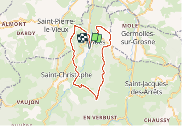
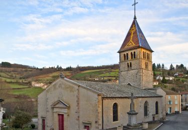
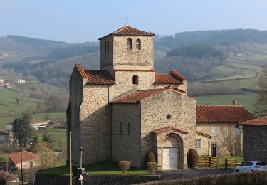
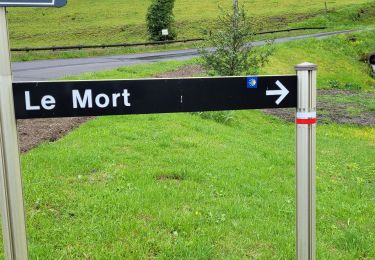
Trail Walking of 13.6 km to be discovered at Auvergne-Rhône-Alpes, Rhône, Deux-Grosnes. This trail is proposed by tracegps.

Description

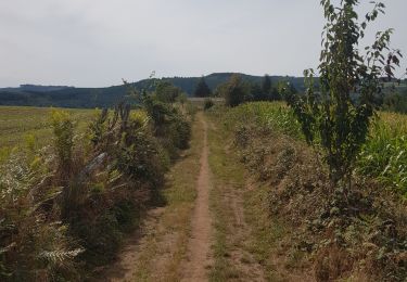
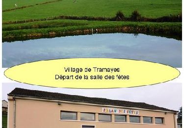
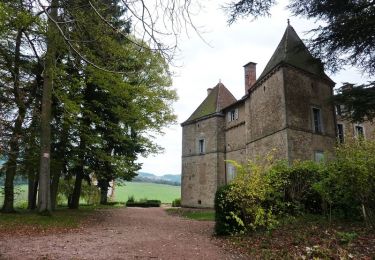
Circuit proposé par l’office de tourisme du Haut-Beaujolais . Ce circuit de 14km commence avec une côte un peu raide, mais se poursuit avec un faible dénivelé, sur les crêtes entourant le village. Cette boucle suit les deux collines qui forment le vallon de la Grosne occidentale, rivière qui alimente le plan d'eau de Trades. Vous pouvez télécharger la fiche du circuit en cliquant ICI.

Elevation profile

Photos

Positioning

Country:
France
Region :
Auvergne-Rhône-Alpes
Department/Province :
Rhône
Municipality :
Deux-Grosnes
Location:
Trades
Start:(UTM)
620050 ; 5125686 (31T) N.

Trails nearby

Trail Walking Deux-Grosnes - Circuit de Saint-Jacques des Arrêts - Photo
Walking
tracegps

Walking

Medium
(1)
Deux-Grosnes, Auvergne-Rhône-Alpes, Rhône, France
11.9 km | 17.3 km-effort
3h 0min
Yes
Trail Walking Deux-Grosnes - Ouroux - Photo
Walking
Galoche

Walking

Difficult
(1)
Deux-Grosnes, Auvergne-Rhône-Alpes, Rhône, France
19.1 km | 0 m-effort
5h 57min
Yes
Trail On foot Deux-Grosnes - Circuit des Sapins - Photo
On foot
PRO

On foot

Difficult
Deux-Grosnes, Auvergne-Rhône-Alpes, Rhône, France
22 km | 33 km-effort
7h 34min
Yes
Trail On foot Deux-Grosnes - Circuit du Bois du Thym - Photo
On foot
PRO

On foot

Easy
Deux-Grosnes, Auvergne-Rhône-Alpes, Rhône, France
6.8 km | 10.6 km-effort
2h 24min
Yes
Trail Walking Deux-Grosnes - Séjour RCY : Les crêtes du Haut Beaujolais journée 3 - Photo
Walking
chessyca

Walking

Very difficult
Deux-Grosnes, Auvergne-Rhône-Alpes, Rhône, France
22 km | 32 km-effort
5h 42min
No
Trail Walking Saint-Pierre-le-Vieux - La Grotte de Saint Pierre le vieux  - Photo
Walking
darrisa

Walking

Difficult
Saint-Pierre-le-Vieux, Bourgogne-Franche-Comté, Saône-et-Loire, France
9.8 km | 13.5 km-effort
3h 42min
Yes
Trail Running Deux-Grosnes - jour 2 CAP Jeanot - Photo
Running
jeannat

Running

Very easy
Deux-Grosnes, Auvergne-Rhône-Alpes, Rhône, France
30 km | 44 km-effort
4h 20min
No
Trail Mountain bike Tramayes - 5ème Trans de La Mère Boîtier (VTT 2012 - grand parcours) - Tramayes - Photo
Mountain bike
tracegps

Mountain bike

Very difficult
Tramayes, Bourgogne-Franche-Comté, Saône-et-Loire, France
52 km | 73 km-effort
5h 15min
Yes
Trail Mountain bike Tramayes - 5ème Trans de La Mère Boîtier (VTT 2012 - petit parcours) - Tramayes - Photo
Mountain bike
tracegps

Mountain bike

Medium
Tramayes, Bourgogne-Franche-Comté, Saône-et-Loire, France
14.7 km | 21 km-effort
1h 45min
Yes


Close
My subscriptions