Trail Walking Plouégat-Moysan - Ménez Meur - Plouégat - Photo

Ménez Meur - Plouégat

 tracegps
tracegps

User

© OpenStreetMap contributors
Length
Length
12.2 km
Max alt
Max alt
254 m
Uphill gradient
Uphill gradient
225 m
Km-Effort
Km-Effort  
15.2 km
Min alt
Min alt
137 m
Downhill gradient
Downhill gradient
225 m
Boucle
Boucle
Yes
Creation date :
2014-12-10 00:00:00.0
Updated on :
2014-12-10 00:00:00.0

(0 Reviews)

Walking
Walking
3h30
Difficulty : Medium

Scan this QR Code to open this trail in the SityTrail application

FREE GPS app for hiking

Logo SityTrail SityTrail

IGN / Geographical institutes

Download SityTrail from the App Store Download SityTrail from Google Play

Logo SityTrail SityTrail World

The world is yours!

Download SityTrail from the App Store Download SityTrail from Google Play Download SityTrail on Huawei AppGallery

About

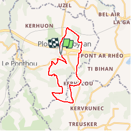
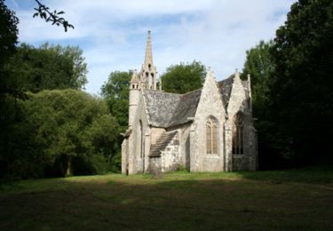
Trail Walking of 12.2 km to be discovered at Brittany, Finistère, Plouégat-Moysan. This trail is proposed by tracegps.

Description

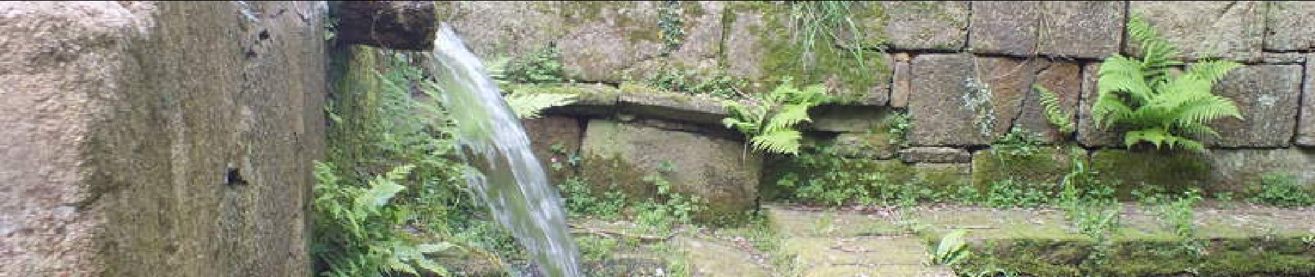
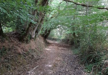
Montée vers les monts d'Arrée à travers bois et landes. Patrimoine: Manoir de Trogoff; menhir de Kerhellou; fontaine St Laurent.

Elevation profile

Photos

Positioning

Country:
France
Region :
Brittany
Department/Province :
Finistère
Municipality :
Plouégat-Moysan
Location:
Unknown
Start:(UTM)
455038 ; 5379509 (30U) N.

Trails nearby

Trail Walking Plounérin - Tro Lann Droënn - Photo
Walking
runarlejou

Walking

Very easy
Plounérin, Brittany, Côtes-d'Armor, France
3.9 km | 4.2 km-effort
1h 49min
Yes
Trail Walking Plounérin - Trop lann Droën - Photo
Walking
runarlejou

Walking

Medium
Plounérin, Brittany, Côtes-d'Armor, France
4 km | 4.4 km-effort
1h 36min
Yes
Trail Walking Botsorhel - Sentiers buissonniers à Botsorhel - Photo
Walking
tracegps

Walking

Difficult
(1)
Botsorhel, Brittany, Finistère, France
14.2 km | 18.5 km-effort
4h 30min
Yes
Trail Walking Plounérin - Tro Lann Droenn - Photo
Walking
runarlejou

Walking

Easy
Plounérin, Brittany, Côtes-d'Armor, France
3.7 km | 3.9 km-effort
1h 21min
Yes
Trail Walking Plouégat-Moysan - Tour du Trégor morlaisien GR® 380 - GR® 34D: Plouégat Moysan - Locquirec - Photo
Walking
tracegps

Walking

Difficult
Plouégat-Moysan, Brittany, Finistère, France
28 km | 33 km-effort
5h 40min
No
Trail Walking Plounérin - Entre Plounérin-Gare et Plouegat-Moysan - Photo
Walking
tracegps

Walking

Medium
Plounérin, Brittany, Côtes-d'Armor, France
10.3 km | 12.3 km-effort
2h 34min
Yes
Trail Walking Botsorhel - 29_Botsorhel - Photo
Walking
jab31

Walking

Medium
Botsorhel, Brittany, Finistère, France
14.3 km | 18.6 km-effort
3h 22min
Yes
Trail Walking Plouigneau - le ponthou - Photo
Walking
baladurien

Walking

Very easy
Plouigneau, Brittany, Finistère, France
7.6 km | 9.3 km-effort
2h 31min
No
Trail Walking Plouégat-Guérand - 29 La Chaise du Curé  - Photo
Walking
Cosmos

Walking

Very easy
Plouégat-Guérand, Brittany, Finistère, France
444 m | 530 m-effort
10min
No


Close
My subscriptions