Trail Equestrian Fay-sur-Lignon - De Fay sur Lignon à Saint Front - Photo

De Fay sur Lignon à Saint Front

 tracegps
tracegps

User

© OpenStreetMap contributors
Length
Length
23 km
Max alt
Max alt
1300 m
Uphill gradient
Uphill gradient
529 m
Km-Effort
Km-Effort  
30 km
Min alt
Min alt
1143 m
Downhill gradient
Downhill gradient
529 m
Boucle
Boucle
Yes
Creation date :
2014-12-10 00:00:00.0
Updated on :
2014-12-10 00:00:00.0

(0 Reviews)

Equestrian
Equestrian
4h49
Difficulty : Medium

Scan this QR Code to open this trail in the SityTrail application

FREE GPS app for hiking

Logo SityTrail SityTrail

IGN / Geographical institutes

Download SityTrail from the App Store Download SityTrail from Google Play

Logo SityTrail SityTrail World

The world is yours!

Download SityTrail from the App Store Download SityTrail from Google Play Download SityTrail on Huawei AppGallery

About

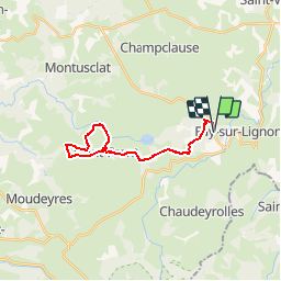
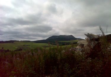
Trail Equestrian of 23 km to be discovered at Auvergne-Rhône-Alpes, Haute-Loire, Fay-sur-Lignon. This trail is proposed by tracegps.

Description

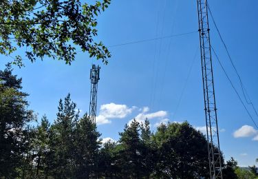
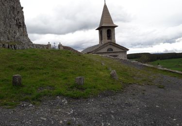
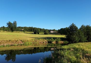
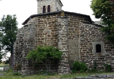
Balade facile pour faire un tour autour du village de St Front. Seule difficulté avant d'arriver à St Front sur la D 263 (ou en repartant) ce morceau de chemin pierreux et pentu. Les point d'eau : - "Bachat à St Front (photo 4) et un ruisseau près de Soleilhac où il faut un seau en toile car comme souvent en Haute-Loire, entouré de fil électrifié

Elevation profile

Photos

Positioning

Country:
France
Region :
Auvergne-Rhône-Alpes
Department/Province :
Haute-Loire
Municipality :
Fay-sur-Lignon
Location:
Unknown
Start:(UTM)
595498 ; 4981955 (31T) N.

Trails nearby

Trail Walking Saint-Front - Tour du lac St Front - Photo
Walking
mallovon

Walking

Medium
(1)
Saint-Front, Auvergne-Rhône-Alpes, Haute-Loire, France
8.5 km | 10.6 km-effort
2h 17min
Yes
Trail Cycle Saint-Clément - ST CLEMENT - Photo
Cycle
eric.mechin

Cycle

Very easy
(1)
Saint-Clément, Auvergne-Rhône-Alpes, Ardèche, France
62 km | 85 km-effort
Unknown
No
Trail Walking Fay-sur-Lignon - Lac de Saint Front depuis  Fay sur Lignon - Photo
Walking
tracegps

Walking

Medium
(1)
Fay-sur-Lignon, Auvergne-Rhône-Alpes, Haute-Loire, France
17.2 km | 23 km-effort
4h 30min
Yes
Trail Walking Saint-Clément - Circuit près de Fay sur LIGNON  - Photo
Walking
Jean-MarieFaux

Walking

Difficult
Saint-Clément, Auvergne-Rhône-Alpes, Ardèche, France
10 km | 12.3 km-effort
2h 27min
No
Trail Walking Mazet-Saint-Voy - Volamont - Photo
Walking
mallovon

Walking

Easy
Mazet-Saint-Voy, Auvergne-Rhône-Alpes, Haute-Loire, France
5 km | 6.7 km-effort
2h 32min
Yes
Trail Walking Saint-Front - massif des roches - Photo
Walking
Nicolesophie08

Walking

Medium
Saint-Front, Auvergne-Rhône-Alpes, Haute-Loire, France
15.8 km | 0 m-effort
7h 11min
No
Trail Walking Mazet-Saint-Voy - Baignade du moulin de Boyer - Photo
Walking
mallovon

Walking

Very easy
Mazet-Saint-Voy, Auvergne-Rhône-Alpes, Haute-Loire, France
3.7 km | 4.8 km-effort
1h 29min
Yes
Trail Walking Saint-Clément - St Clément - Photo
Walking
mallovon

Walking

Medium
Saint-Clément, Auvergne-Rhône-Alpes, Ardèche, France
4.3 km | 6.3 km-effort
1h 24min
Yes
Trail Snowshoes Chaudeyrolles - Sur les pas de J. Vallès - Chaudeyrolles - Photo
Snowshoes
tracegps

Snowshoes

Medium
Chaudeyrolles, Auvergne-Rhône-Alpes, Haute-Loire, France
11.5 km | 14.5 km-effort
4h 0min
Yes


Close
My subscriptions