


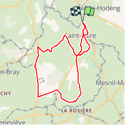

11.5 km | 13 km-effort

User


FREE GPS app for hiking
 SityTrail
IGN / Geographical institutes
SityTrail World
The world is yours!
Trail Cycle of 15 km to be discovered at Normandy, Seine-Maritime, Saint-Saire. This trail is proposed by tracegps.
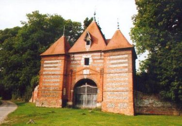
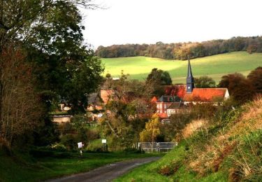
Circuit proposé par l'Office de Tourisme du Pays de Neufchâtelois. Départ du passage à niveau 70 de l'avenue Verte. Sur ce circuit, vous découvrirez des éléments patrimoniaux particulièrement représentés sur la commune de Saint-Saire: les calvaires. Ces sept croix en fonte et béton avaient pour mission de guider, protéger ou de permettre aux passants de prier et d’invoquer un saint en toute discrétion. Des aires de pique-nique et de repos aménagées vous permettront de découvrir la commune en toute tranquillité !


Walking
Cycle

Cycle
Cycle

Cycle
Mountain bike
Mountain bike
Mountain bike

Walking