Trail Cycle Neuville-Ferrières - La Bonde - Neuville Ferrières - Photo

La Bonde - Neuville Ferrières

 tracegps
tracegps

User

© OpenStreetMap contributors
Length
Length
29 km
Max alt
Max alt
224 m
Uphill gradient
Uphill gradient
437 m
Km-Effort
Km-Effort  
35 km
Min alt
Min alt
86 m
Downhill gradient
Downhill gradient
434 m
Boucle
Boucle
Yes
Creation date :
2014-12-10 00:00:00.0
Updated on :
2014-12-10 00:00:00.0

(0 Reviews)

Cycle
Cycle
2h30
Difficulty : Medium

Scan this QR Code to open this trail in the SityTrail application

FREE GPS app for hiking

Logo SityTrail SityTrail

IGN / Geographical institutes

Download SityTrail from the App Store Download SityTrail from Google Play

Logo SityTrail SityTrail World

The world is yours!

Download SityTrail from the App Store Download SityTrail from Google Play Download SityTrail on Huawei AppGallery

About

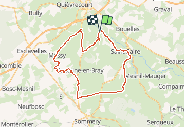
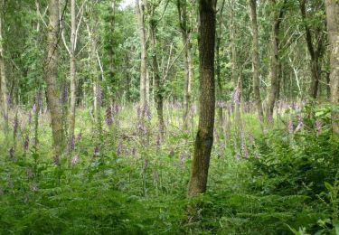
Trail Cycle of 29 km to be discovered at Normandy, Seine-Maritime, Neuville-Ferrières. This trail is proposed by tracegps.

Description

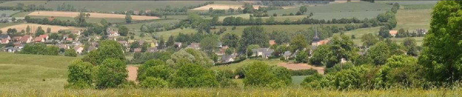
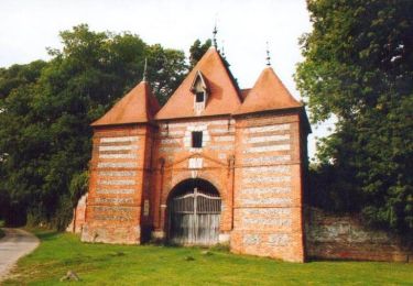
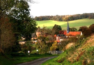
Circuit proposé par l'Office de Tourisme du Pays de Neufchâtelois. Départ de la place de la mairie. Sur ce parcours, remarquez les similitudes entre les clochers des églises de Saint-Saire et Sainte-Geneviève-en-Bray : tous deux en forme de hache. A Massy une petite sente vous conduit depuis l’église jusqu’au lavoir communal. Dans le village, vous pouvez aussi visiter Artmazia, un centre artistique avec le deuxième plus long labyrinthe permanent au monde et des points de vue fantastiques sur la Boutonnière du Pays de Bray.

Elevation profile

Photos

Positioning

Country:
France
Region :
Normandy
Department/Province :
Seine-Maritime
Municipality :
Neuville-Ferrières
Location:
Unknown
Start:(UTM)
388751 ; 5507604 (31U) N.

Trails nearby

Trail Walking Saint-Saire - St-Saire - Forges-les-Eaux - GD - Photo
Walking
philippe76

Walking

Difficult
(1)
Saint-Saire, Normandy, Seine-Maritime, France
11.5 km | 13 km-effort
3h 9min
No
Trail Cycle Saint-Saire - Le petit tour vélo du Neufchâtelois - Saint-Saire - Photo
Cycle
tracegps

Cycle

Medium
Saint-Saire, Normandy, Seine-Maritime, France
61 km | 73 km-effort
5h 0min
Yes
Trail Cycle Saint-Saire - Le Grand Tour vélo du Neufchâtelois - Saint-Saire - Photo
Cycle
tracegps

Cycle

Difficult
Saint-Saire, Normandy, Seine-Maritime, France
78 km | 94 km-effort
6h 30min
Yes
Trail Cycle Saint-Saire - La boucle des Calvaires - Saint-Saire - Photo
Cycle
tracegps

Cycle

Easy
Saint-Saire, Normandy, Seine-Maritime, France
15 km | 17.9 km-effort
1h 15min
Yes
Trail Cycle Nesle-Hodeng - Le coeur - Nesle Hodeng - Photo
Cycle
tracegps

Cycle

Medium
Nesle-Hodeng, Normandy, Seine-Maritime, France
33 km | 39 km-effort
3h 0min
Yes
Trail Mountain bike Neufchâtel-en-Bray - Le tour du Pays Neufchâtelois - Neufchâtel en Bray - Photo
Mountain bike
tracegps

Mountain bike

Very difficult
Neufchâtel-en-Bray, Normandy, Seine-Maritime, France
111 km | 134 km-effort
11h 0min
Yes
Trail Mountain bike Nesle-Hodeng - A partir de Nesle-Hodeng - Photo
Mountain bike
tracegps

Mountain bike

Medium
Nesle-Hodeng, Normandy, Seine-Maritime, France
23 km | 28 km-effort
2h 30min
Yes
Trail Mountain bike Bouelles - Vers la Forêt d'Eu - Bouelles - Photo
Mountain bike
tracegps

Mountain bike

Medium
Bouelles, Normandy, Seine-Maritime, France
33 km | 40 km-effort
2h 40min
Yes
Trail Walking Bouelles - Vers la Forêt d'Eu - Bouelles - Photo
Walking
tracegps

Walking

Very difficult
(1)
Bouelles, Normandy, Seine-Maritime, France
33 km | 40 km-effort
8h 10min
Yes


Close
My subscriptions