Trail Walking Fournels - De Fournels  à St-Chély-d'Apcher - Photo

De Fournels à St-Chély-d'Apcher

 tracegps
tracegps

User

© OpenStreetMap contributors
Length
Length
17.7 km
Max alt
Max alt
1197 m
Uphill gradient
Uphill gradient
394 m
Km-Effort
Km-Effort  
23 km
Min alt
Min alt
957 m
Downhill gradient
Downhill gradient
342 m
Boucle
Boucle
No
Creation date :
2014-12-10 00:00:00.0
Updated on :
2014-12-10 00:00:00.0

(0 Reviews)

Walking
Walking
4h10
Difficulty : Difficult

Scan this QR Code to open this trail in the SityTrail application

FREE GPS app for hiking

Logo SityTrail SityTrail

IGN / Geographical institutes

Download SityTrail from the App Store Download SityTrail from Google Play

Logo SityTrail SityTrail World

The world is yours!

Download SityTrail from the App Store Download SityTrail from Google Play Download SityTrail on Huawei AppGallery

About

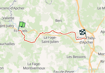
Trail Walking of 17.7 km to be discovered at Occitania, Lozère, Fournels. This trail is proposed by tracegps.

Description

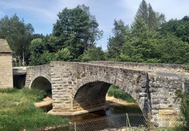
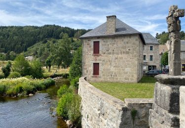
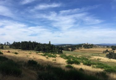
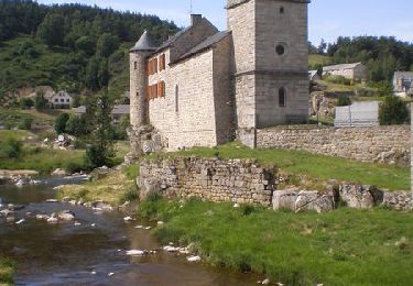
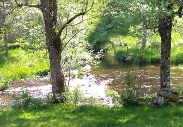
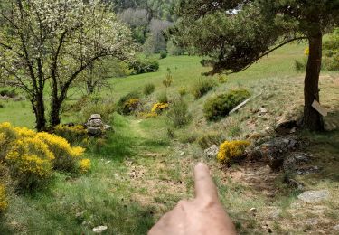
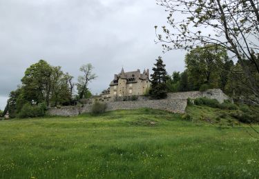
Départ devant "les hameaux de la Lozère". On parvient à Pruniérette, on continue sur Termes puis le chemin nous mène à travers prairies et bois jusqu'au moulin de la Grifette. On continue à travers la forêt jusque St-Chély-d'Apcher.

Elevation profile

Photos

Positioning

Country:
France
Region :
Occitania
Department/Province :
Lozère
Municipality :
Fournels
Location:
Unknown
Start:(UTM)
509119 ; 4962607 (31T) N.

Trails nearby

Trail On foot Chauchailles - 2022-05-31_19h34m27_gpx-trace - Photo
On foot
audier

On foot

Difficult
(1)
Chauchailles, Occitania, Lozère, France
22 km | 31 km-effort
7h 7min
Yes
Trail Walking Chauchailles - sentier des espagnols  - Photo
Walking
GUIDE
nadinebondoux

Walking

Difficult
Chauchailles, Occitania, Lozère, France
22 km | 32 km-effort
6h 48min
Yes
Trail Walking Chauchailles - Gorges du Bèz sentier des espagnols - Photo
Walking
GUIDE
Roger Philippe Wallez

Walking

Very difficult
Chauchailles, Occitania, Lozère, France
22 km | 31 km-effort
7h 34min
Yes
Trail Walking Termes - TERMES 48 - autour de la Rau de la FAGE  - Photo
Walking
jeff66

Walking

Medium
Termes, Occitania, Lozère, France
12.2 km | 15.4 km-effort
2h 36min
Yes
Trail Walking Termes - TERMES 48 - petit circuit - Photo
Walking
jeff66

Walking

Easy
(1)
Termes, Occitania, Lozère, France
7.3 km | 8.8 km-effort
1h 46min
Yes
Trail Walking Chauchailles - Les Gorges du Bes - Photo
Walking
tracegps

Walking

Difficult
(1)
Chauchailles, Occitania, Lozère, France
21 km | 30 km-effort
7h 0min
Yes
Trail Walking Termes - Termes Aumont aubrac - Photo
Walking
himba26100

Walking

Medium
Termes, Occitania, Lozère, France
19.1 km | 23 km-effort
7h 22min
No
Trail Walking Saint-Juéry - Le Bes - Photo
Walking
viam19

Walking

Difficult
Saint-Juéry, Occitania, Lozère, France
15.3 km | 21 km-effort
7h 20min
Yes
Trail Walking Chauchailles - Chauchailles à Termes - Photo
Walking
dominiq

Walking

Chauchailles, Occitania, Lozère, France
18.8 km | 26 km-effort
4h 56min
No


Close
My subscriptions