Trail Walking Passy - Col et Lac d'Anterne - Passy Plaine-Joux - Photo

Col et Lac d'Anterne - Passy Plaine-Joux

 tracegps
tracegps

User

© OpenStreetMap contributors
Length
Length
20 km
Max alt
Max alt
2253 m
Uphill gradient
Uphill gradient
1199 m
Km-Effort
Km-Effort  
36 km
Min alt
Min alt
1353 m
Downhill gradient
Downhill gradient
1199 m
Boucle
Boucle
Yes
Creation date :
2014-12-10 00:00:00.0
Updated on :
2014-12-10 00:00:00.0

(1 Reviews)

Walking
Walking
6h30
Difficulty : Difficult

Scan this QR Code to open this trail in the SityTrail application

FREE GPS app for hiking

Logo SityTrail SityTrail

IGN / Geographical institutes

Download SityTrail from the App Store Download SityTrail from Google Play

Logo SityTrail SityTrail World

The world is yours!

Download SityTrail from the App Store Download SityTrail from Google Play Download SityTrail on Huawei AppGallery

About

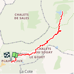
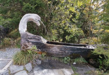
Trail Walking of 20 km to be discovered at Auvergne-Rhône-Alpes, Upper Savoy, Passy. This trail is proposed by tracegps.

Description

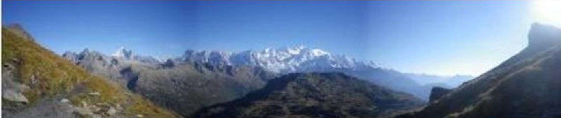
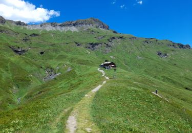
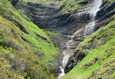
Point de départ : Parking de Plaine-Joux. Dénivelé   : 1525m Description : Prenez la route 4x4 en direction du refuge de Moëde Anterne, en passant par le Barmus. Arrivée au niveau du refuge de Moëde Anterne, empruntez le sentier sur votre gauche direction le col d’Anterne. Cette partie refuge-col est raide, modérez votre allure. Du col, le lac se trouve à une quarantaine de minutes, en contrebas. Le Col d’Anterne est l’un des plus beaux points de vue de la randonnée. Depuis le col, vous avez une vue imprenable sur le massif du Mont-Blanc, les aiguilles rouges, la pointe noire de Pormenaz et son lac. Le côté opposé, vous découvrez le vallon d’Anterne et son incroyable façade sur votre gauche.

Elevation profile

Photos

Positioning

Country:
France
Region :
Auvergne-Rhône-Alpes
Department/Province :
Upper Savoy
Municipality :
Passy
Location:
Unknown
Start:(UTM)
324829 ; 5091090 (32T) N.

Comments

Please log in to post a review or rate the element


Trails nearby

Trail Walking Passy - Tour des Ayères - Passy Plaine-Joux - Photo
Walking
tracegps

Walking

Medium
(6)
Passy, Auvergne-Rhône-Alpes, Upper Savoy, France
9 km | 14.3 km-effort
2h 30min
Yes
Trail Walking Passy - Plaine Joux Barmus Ayères Lac Vert  - Photo
Walking
GUIDE
Kargil

Walking

Very easy
(1)
Passy, Auvergne-Rhône-Alpes, Upper Savoy, France
7.6 km | 12.2 km-effort
2h 18min
Yes
Trail Walking Passy - Tour de la chaine des Fiz par le passage du Dérochoir - Photo
Walking
tracegps

Walking

Very difficult
(1)
Passy, Auvergne-Rhône-Alpes, Upper Savoy, France
47 km | 90 km-effort
18h 0min
Yes
Trail Walking Passy - Plaine Joux-Passage du derochoir-Col de Portette-Platé - Photo
Walking
GUIDE
Kargil

Walking

Difficult
Passy, Auvergne-Rhône-Alpes, Upper Savoy, France
14.4 km | 30 km-effort
6h 42min
Yes
Trail Running Passy - grimpe de chedde ayeres - Photo
Running
winbat11

Running

Very easy
(1)
Passy, Auvergne-Rhône-Alpes, Upper Savoy, France
15 km | 28 km-effort
2h 46min
No
Trail Walking Passy - SIXT PASSY RESERVE: PLAINE JOUX- LAC DE PORMENAZ - REFUGE DE MOEDE ANTERNE - retour par la piste - Photo
Walking
djeepee74

Walking

Difficult
Passy, Auvergne-Rhône-Alpes, Upper Savoy, France
16.7 km | 28 km-effort
5h 34min
Yes
Trail Snowshoes Passy - 05-03-2022 Plaine Joux - Chalet du Souay - Photo
Snowshoes
GUIDE
Kargil

Snowshoes

Easy
Passy, Auvergne-Rhône-Alpes, Upper Savoy, France
9.2 km | 15.2 km-effort
2h 41min
Yes
Trail Walking Passy - CHAMONIX ... par les Ayères.  - Photo
Walking
GerardBouche

Walking

Medium
Passy, Auvergne-Rhône-Alpes, Upper Savoy, France
8.8 km | 14.5 km-effort
2h 48min
Yes
Trail Walking Passy - Col d anterne  - Photo
Walking
joelinou

Walking

Very difficult
Passy, Auvergne-Rhône-Alpes, Upper Savoy, France
18.6 km | 33 km-effort
6h 39min
Yes


Close
My subscriptions