Trail Walking Pianello - Punta di Caldane - Poggio - Photo

Punta di Caldane - Poggio

 tracegps
tracegps

User

© OpenStreetMap contributors
Length
Length
11.7 km
Max alt
Max alt
1712 m
Uphill gradient
Uphill gradient
945 m
Km-Effort
Km-Effort  
24 km
Min alt
Min alt
887 m
Downhill gradient
Downhill gradient
945 m
Boucle
Boucle
Yes
Creation date :
2014-12-10 00:00:00.0
Updated on :
2014-12-10 00:00:00.0

(1 Reviews)

Walking
Walking
6h00
Difficulty : Medium

Scan this QR Code to open this trail in the SityTrail application

FREE GPS app for hiking

Logo SityTrail SityTrail

IGN / Geographical institutes

Download SityTrail from the App Store Download SityTrail from Google Play

Logo SityTrail SityTrail World

The world is yours!

Download SityTrail from the App Store Download SityTrail from Google Play Download SityTrail on Huawei AppGallery

About

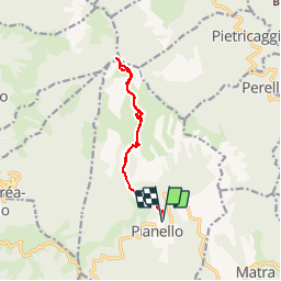
Trail Walking of 11.7 km to be discovered at Corsica, Haute-Corse, Pianello. This trail is proposed by tracegps.

Description

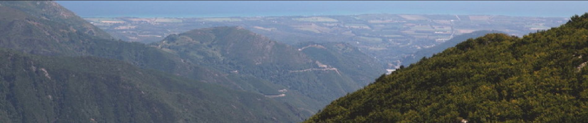
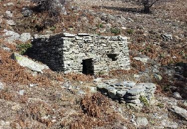
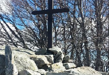
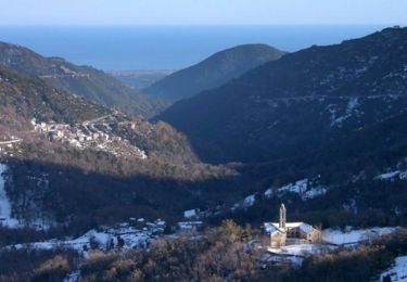
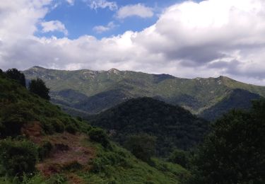
Punta di Caldane, n’est pas le point culminant de la Castagniccia, mais le sommet le plus méridional du chaînon central. A l’exception du secteur nord, on bénéficie d'un beau panorama, sur la côte Est d’une part et les principaux sommets de la Corse d’autre part. Si la randonnée depuis Poggio ne présente aucune difficulté technique, l’absence de balisage, de cairns, et de sentier sur le dernier tronçon, pourra poser quelques difficultés, à moins de disposer de la trace GPS. Ce sommet n’est pratiquement pas fréquenté par les vacanciers randonneurs, mais semble plutôt réservé au berger de Peri et à quelques résidants de la Castagniccia. La description complète et de nombreuses autres ici.

Elevation profile

Photos

Points of interest

Point of interest Pianello - Départ - Photo
tracegps
PIANELLO 
Point of interest Pianello - Punta di Caldane - Photo
tracegps
Point of interest Pianello - Source - Photo
tracegps
PIANELLO 

Positioning

Country:
France
Region :
Corsica
Department/Province :
Haute-Corse
Municipality :
Pianello
Location:
Unknown
Start:(UTM)
529793 ; 4682252 (32T) N.

Comments

Please log in to post a review or rate the element


Corse 18/10/2015


Trails nearby

Trail Walking Pianello - Pta Caldane - Photo
Walking
olivecoco

Walking

Medium
Pianello, Corsica, Haute-Corse, France
13.5 km | 27 km-effort
5h 17min
Yes
Trail Walking Pianello - Pta Caldane - Photo
Walking
olivecoco

Walking

Easy
Pianello, Corsica, Haute-Corse, France
13.5 km | 27 km-effort
5h 15min
Yes
Trail Walking Pianello - Pta Caldane - Photo
Walking
olivecoco

Walking

Medium
Pianello, Corsica, Haute-Corse, France
13.5 km | 27 km-effort
5h 17min
Yes
Trail Walking Pianello - GR® de Corse - Mare a Mare Nord - De Pianellu à Sermano - Photo
Walking
tracegps

Walking

Difficult
Pianello, Corsica, Haute-Corse, France
12.4 km | 19.2 km-effort
4h 49min
No
Trail Walking Perelli - ALBG COUVENT D ALESANI - Photo
Walking
albg

Walking

Medium
Perelli, Corsica, Haute-Corse, France
6.4 km | 11.3 km-effort
2h 33min
Yes
Trail Walking Pianello - Punta Di caldane  - Photo
Walking
Antoine Grateau

Walking

Very easy
Pianello, Corsica, Haute-Corse, France
9.8 km | 24 km-effort
2h 13min
Yes
Trail Walking Perelli - teraccia - Photo
Walking
lepage

Walking

Very easy
Perelli, Corsica, Haute-Corse, France
1.8 km | 3.3 km-effort
34min
No
Trail Walking Pianello - Mam nord 3 - Photo
Walking
collinet18

Walking

Pianello, Corsica, Haute-Corse, France
12.7 km | 21 km-effort
4h 32min
No
Trail Walking Valle-d'Alesani - Mam nord 2 - Photo
Walking
collinet18

Walking

Easy
Valle-d'Alesani, Corsica, Haute-Corse, France
14.3 km | 24 km-effort
5h 31min
No


Close
My subscriptions