


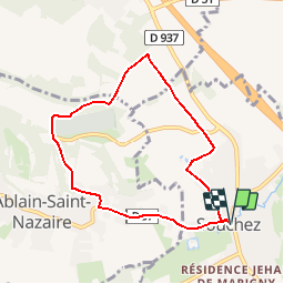

14.3 km | 16.7 km-effort

User


FREE GPS app for hiking
 SityTrail
IGN / Geographical institutes
SityTrail World
The world is yours!
Trail Walking of 6.7 km to be discovered at Hauts-de-France, Pas-de-Calais, Souchez. This trail is proposed by tracegps.
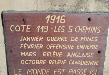
Randonnée autour du site de Notre Dame de Lorette à partir de la mairie de Souchez.


Walking

Walking
Nordic walking
Walking

Other activity

Other activity

Running
Walking

Walking