Trail Running Saint-Maximin - St-Maximin et la vallée d'Eure - Photo

St-Maximin et la vallée d'Eure

 tracegps
tracegps

User

© OpenStreetMap contributors
Length
Length
18 km
Max alt
Max alt
184 m
Uphill gradient
Uphill gradient
406 m
Km-Effort
Km-Effort  
23 km
Min alt
Min alt
69 m
Downhill gradient
Downhill gradient
402 m
Boucle
Boucle
Yes
Creation date :
2014-12-10 00:00:00.0
Updated on :
2014-12-10 00:00:00.0

(1 Reviews)

Running
Running
2h00
Difficulty : Medium

Scan this QR Code to open this trail in the SityTrail application

FREE GPS app for hiking

Logo SityTrail SityTrail

IGN / Geographical institutes

Download SityTrail from the App Store Download SityTrail from Google Play

Logo SityTrail SityTrail World

The world is yours!

Download SityTrail from the App Store Download SityTrail from Google Play Download SityTrail on Huawei AppGallery

About

Trail Running of 18 km to be discovered at Occitania, Gard, Saint-Maximin. This trail is proposed by tracegps.

Description

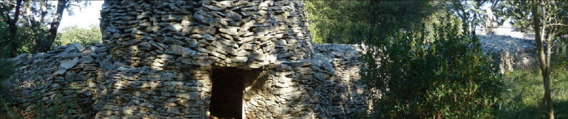
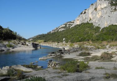
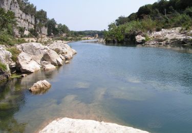
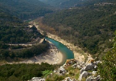
Ce parcours vallonné vous entraîne sur les traces de l'aqueduc romain et de la source qui a permis au Romains de l'alimenter. La garrigue et ses capitelles de pierres sèches ainsi que le 1er Ducher de France. Du cimetière de St-Maximin descendre vers la plaine en suivant les balisages jaunes. Après l'aqueduc remonter une combe et gagner une pinède et le "château Berard" puis la rivière de "l'Eure". Faire le tour de cette reposante vallée et remonter vers la table d’orientation. Gagner les planes et le "sentier des capitelles" puis le plateau de St Siffret avant de retourner à St Maximin. Bonne balade.

Elevation profile

Photos

Positioning

Country:
France
Region :
Occitania
Department/Province :
Gard
Municipality :
Saint-Maximin
Location:
Unknown
Start:(UTM)
616138 ; 4872112 (31T) N.

Comments

Please log in to post a review or rate the element


Trails nearby

Trail Walking Argilliers - Les Darbounelles - Argilliers - Photo
Walking
tracegps

Walking

Medium
(1)
Argilliers, Occitania, Gard, France
11.4 km | 13.9 km-effort
3h 0min
Yes
Trail Walking Collias - La Baume par Collias - Photo
Walking
tracegps

Walking

Medium
(2)
Collias, Occitania, Gard, France
13.3 km | 18.1 km-effort
4h 0min
Yes
Trail Walking Collias - PF-Collias - Les Gorges du Gardon - Photo
Walking
MicDul

Walking

Easy
(1)
Collias, Occitania, Gard, France
12.9 km | 16.4 km-effort
3h 39min
Yes
Trail Walking Saint-Siffret - au départ de St Siffrey - Photo
Walking
GUIDE
nadinebondoux

Walking

Medium
Saint-Siffret, Occitania, Gard, France
18.2 km | 22 km-effort
5h 27min
Yes
Trail Walking Uzès - 2 Uzès par ch des amoureux Arpaillargues  - Photo
Walking
caroline116

Walking

Medium
(1)
Uzès, Occitania, Gard, France
8 km | 10 km-effort
1h 51min
Yes
Trail On foot Collias - L'Ermitage de Collias - Photo
On foot
PRO

On foot

Easy
Collias, Occitania, Gard, France
5.3 km | 7 km-effort
1h 35min
No
Trail Mountain bike Uzès - GARD VTT 2017 J3 - Photo
Mountain bike
Mariolebeno

Mountain bike

Medium
(2)
Uzès, Occitania, Gard, France
48 km | 60 km-effort
3h 53min
No
Trail Walking Sanilhac-Sagriès - la baume - Photo
Walking
myl

Walking

Easy
(1)
Sanilhac-Sagriès, Occitania, Gard, France
10.5 km | 14 km-effort
4h 25min
Yes
Trail Walking Collias - COLLIAS - ROCHERS TROUES - ERMITAGE LAVAL-COLIAS - 13.6Km - 04h00 - Dénivelé 250 m - Photo
Walking
dansmabulle

Walking

Medium
(1)
Collias, Occitania, Gard, France
13.6 km | 18.1 km-effort
3h 57min
Yes


Close
My subscriptions