Trail Walking Ger - Le plateau de Ger en Béarn - Photo

Le plateau de Ger en Béarn

 tracegps
tracegps

User

© OpenStreetMap contributors
Length
Length
23 km
Max alt
Max alt
406 m
Uphill gradient
Uphill gradient
313 m
Km-Effort
Km-Effort  
28 km
Min alt
Min alt
284 m
Downhill gradient
Downhill gradient
313 m
Boucle
Boucle
Yes
Creation date :
2014-12-10 00:00:00.0
Updated on :
2014-12-10 00:00:00.0

(2 Reviews)

Walking
Walking
6h30
Difficulty : Medium

Scan this QR Code to open this trail in the SityTrail application

FREE GPS app for hiking

Logo SityTrail SityTrail

IGN / Geographical institutes

Download SityTrail from the App Store Download SityTrail from Google Play

Logo SityTrail SityTrail World

The world is yours!

Download SityTrail from the App Store Download SityTrail from Google Play Download SityTrail on Huawei AppGallery

About

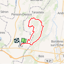
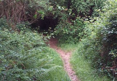
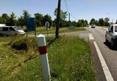
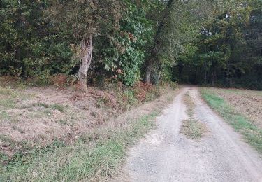
Trail Walking of 23 km to be discovered at New Aquitaine, Pyrénées-Atlantiques, Ger. This trail is proposed by tracegps.

Description

Départ depuis la place du foyer rural de Ger en Béarn, pour découvrir les communes de Pintac, Tarasteix, Oroix, par le GR101 et des sentiers non balisés, pour passer ensuite au retour devant le Menhir de Ger. Randonnée un peu longue mais sans difficulté.

Elevation profile

Photos

Positioning

Country:
France
Region :
New Aquitaine
Department/Province :
Pyrénées-Atlantiques
Municipality :
Ger
Location:
Unknown
Start:(UTM)
739233 ; 4793108 (30T) N.

Comments

Please log in to post a review or rate the element


Trails nearby

Trail Walking Ger - GER MANAS balisage creation   3055925 - Photo
Walking
GUIDE
marmotte65

Walking

Easy
(1)
Ger, New Aquitaine, Pyrénées-Atlantiques, France
2.7 km | 3.1 km-effort
55min
Yes
Trail Walking Aast - RS AAST Sayetes Long - Photo
Walking
LouisROGER

Walking

Very easy
(1)
Aast, New Aquitaine, Pyrénées-Atlantiques, France
4.3 km | 4.6 km-effort
1h 1min
Yes
Trail Walking Ger - GER la galette de ses reines et rois le 4/01/2023
Walking
GUIDE
marmotte65

Walking

Easy
Ger, New Aquitaine, Pyrénées-Atlantiques, France
5 km | 5.5 km-effort
1h 30min
Yes
Trail Walking Ibos - MN2 ibos bois de bergos   - Photo
Walking
nadami

Walking

Medium
(1)
Ibos, Occitania, Hautespyrenees, France
8.9 km | 11.5 km-effort
2h 19min
Yes
Trail Nordic walking Ibos - MN1 serre Caute BOIS DE BROUHENA - Photo
Nordic walking
nadami

Nordic walking

Very easy
(1)
Ibos, Occitania, Hautespyrenees, France
11.5 km | 14 km-effort
2h 32min
Yes
Trail Nordic walking Ibos - bergos nordique fait - Photo
Nordic walking
LouisROGER

Nordic walking

Very easy
Ibos, Occitania, Hautespyrenees, France
8.5 km | 10.2 km-effort
2h 21min
Yes
Trail Walking Oroix - SityTrail - bois d oroix Mn2 - Photo
Walking
LouisROGER

Walking

Medium
(1)
Oroix, Occitania, Hautespyrenees, France
7.7 km | 9.3 km-effort
2h 1min
Yes
Trail Walking Ibos - boisduc - Photo
Walking
LouisROGER

Walking

Very easy
Ibos, Occitania, Hautespyrenees, France
4.4 km | 4.9 km-effort
1h 10min
Yes
Trail Mountain bike Ger - RSlac deponsonbois du poey2022 - Photo
Mountain bike
LouisROGER

Mountain bike

Easy
Ger, New Aquitaine, Pyrénées-Atlantiques, France
5.7 km | 6.3 km-effort
32min
Yes


Close
My subscriptions