Trail Mountain bike Rognes - tour-Rognes/ le Puy - Photo
 oboiron
oboiron

User

© OpenStreetMap contributors
Length
Length
22 km
Max alt
Max alt
502 m
Uphill gradient
Uphill gradient
488 m
Km-Effort
Km-Effort  
29 km
Min alt
Min alt
219 m
Downhill gradient
Downhill gradient
488 m
Boucle
Boucle
Yes
Creation date :
2014-12-10 00:00:00.0
Updated on :
2014-12-10 00:00:00.0

(0 Reviews)

Mountain bike
Mountain bike
2h01
Difficulty : Medium

Scan this QR Code to open this trail in the SityTrail application

FREE GPS app for hiking

Logo SityTrail SityTrail

IGN / Geographical institutes

Download SityTrail from the App Store Download SityTrail from Google Play

Logo SityTrail SityTrail World

The world is yours!

Download SityTrail from the App Store Download SityTrail from Google Play Download SityTrail on Huawei AppGallery

About

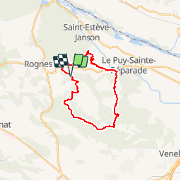
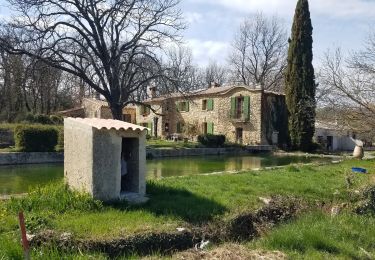
Trail Mountain bike of 22 km to be discovered at Provence-Alpes-Côte d'Azur, Bouches-du-Rhône, Rognes. This trail is proposed by oboiron.

Description

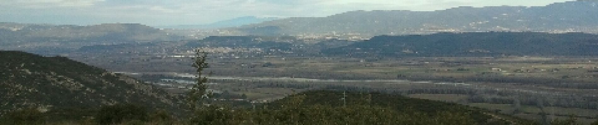
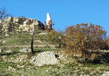
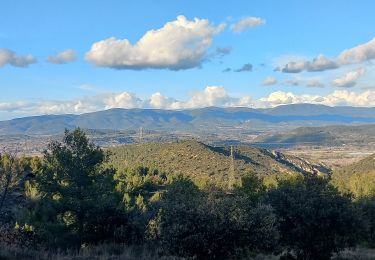
Boucle sur les Communes de Rognes et du Puy Ste Reparade. Jolie vue sur la vallee de la Durance
         

Elevation profile

Photos

Positioning

Country:
France
Region :
Provence-Alpes-Côte d'Azur
Department/Province :
Bouches-du-Rhône
Municipality :
Rognes
Location:
Unknown
Start:(UTM)
691856 ; 4836250 (31T) N.

Trails nearby

Trail Walking Rognes - Rognes virée dans les vignes sur le sentier des vignerons - Photo
Walking
jll7513

Walking

Easy
Rognes, Provence-Alpes-Côte d'Azur, Bouches-du-Rhône, France
11.1 km | 14.1 km-effort
3h 12min
Yes
Trail Walking Rognes - mini sentier des vignerons  - Photo
Walking
patrickmays3

Walking

Easy
Rognes, Provence-Alpes-Côte d'Azur, Bouches-du-Rhône, France
10.5 km | 13.1 km-effort
2h 34min
Yes
Trail Walking Saint-Cannat - l étape. cricri.... - Photo
Walking
NADINE52

Walking

Very easy
Saint-Cannat, Provence-Alpes-Côte d'Azur, Bouches-du-Rhône, France
8.6 km | 10.2 km-effort
2h 12min
Yes
Trail Walking Le Puy-Sainte-Réparade - st canadet - Photo
Walking
Ulle

Walking

Very easy
Le Puy-Sainte-Réparade, Provence-Alpes-Côte d'Azur, Bouches-du-Rhône, France
4.8 km | 6.3 km-effort
1h 59min
No
Trail Walking Rognes - Rognes Saint Christophe  - Photo
Walking
hndupont

Walking

Medium
Rognes, Provence-Alpes-Côte d'Azur, Bouches-du-Rhône, France
8.3 km | 10.9 km-effort
2h 34min
Yes
Trail Walking Rognes - Rognes - Photo
Walking
counoise

Walking

Easy
Rognes, Provence-Alpes-Côte d'Azur, Bouches-du-Rhône, France
12.3 km | 16.2 km-effort
2h 30min
Yes
Trail Hybrid bike Rognes - rognes 4 oct22 - Photo
Hybrid bike
laurentnerual

Hybrid bike

Very difficult
Rognes, Provence-Alpes-Côte d'Azur, Bouches-du-Rhône, France
60 km | 69 km-effort
5h 10min
No
Trail Walking Le Puy-Sainte-Réparade - La Quille - Photo
Walking
Migueldefrance

Walking

Very easy
Le Puy-Sainte-Réparade, Provence-Alpes-Côte d'Azur, Bouches-du-Rhône, France
6.1 km | 7.8 km-effort
2h 49min
Yes
Trail Walking Rognes - Marcellin-Pellegrin-Caireval - Photo
Walking
Berpav

Walking

Easy
(1)
Rognes, Provence-Alpes-Côte d'Azur, Bouches-du-Rhône, France
9.5 km | 11.8 km-effort
2h 21min
Yes


Close
My subscriptions