


Thierenbach Col Amic

bob68
User

Length
14.3 km

Max alt
910 m

Uphill gradient
609 m
Km-Effort
22 km

Min alt
347 m

Downhill gradient
611 m
Boucle
Yes
Creation date :
2014-12-10 00:00:00.0
Updated on :
2014-12-10 00:00:00.0
3h18
Difficulty : Easy

FREE GPS app for hiking
 SityTrail
IGN / Geographical institutes
SityTrail Plus
The world is yours!
About
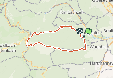
Trail Walking of 14.3 km to be discovered at Grand Est, Haut-Rhin, Jungholtz. This trail is proposed by bob68.
Positioning
Country:
France
Region :
Grand Est
Department/Province :
Haut-Rhin
Municipality :
Jungholtz
Location:
Unknown
Start:(Dec)
Start:(UTM)
364662 ; 5304676 (32T) N.
Comments