


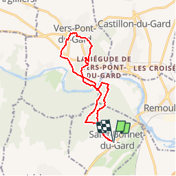


6.8 km | 8.6 km-effort


User


FREE GPS app for hiking
 SityTrail
IGN / Geographical institutes
SityTrail World
The world is yours!
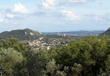
Trail Walking of 14.5 km to be discovered at Occitania, Gard, Saint-Bonnet-du-Gard. This trail is proposed by mpalatan.
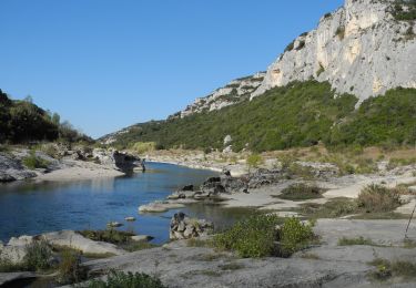
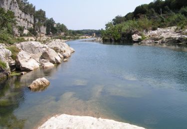
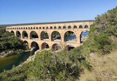
Nous sommes admiratifs à la pensée que plus de mille romains ont travaillé pendant 15 ans (première moitié du 1er siècle) pour réaliser cet ouvrage long de 275 mètres, haut de 49 mètres et comportant 3 niveaux. C' est la partie monumentale d' un aqueduc de 49 702 mètres qui transportait l' eau de la Fontaine d'Eure jusqu' à la ville romaine de "Nemausus" appelée aujourd' hui "Nîmes". Le débit moyen à été estimé à 40000 m3/Jour. Par gravité, l' eau mettait 1 jour pour parvenir depuis son point de captage jusqu' à la ville de Nîmes.
http://capfrandos.free.fr/pontdugard2.htm

Walking

Walking
Walking
Walking
On foot
Walking
Walking

Walking
Walking
superbe visite autour du pont du Gard. très belle randonnée. a part quelques chemins moins beaux que d'autres, la randonnée se fait sans difficultés majeurs