


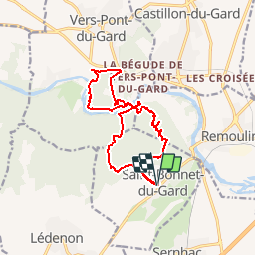

6.8 km | 8.6 km-effort


User


FREE GPS app for hiking
 SityTrail
IGN / Geographical institutes
SityTrail World
The world is yours!
Trail Walking of 15.8 km to be discovered at Occitania, Gard, Saint-Bonnet-du-Gard. This trail is proposed by dansmabulle.
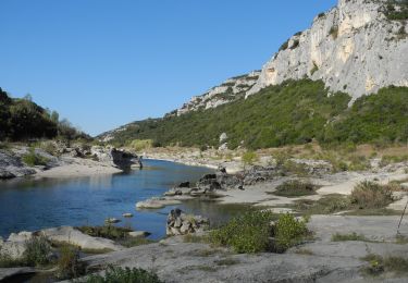
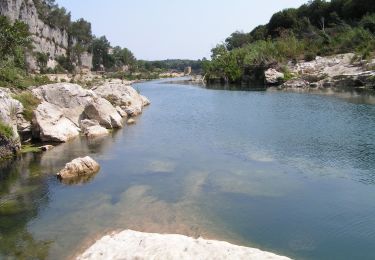
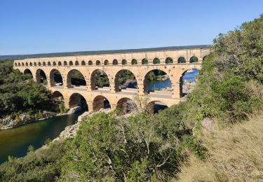
Départ randonnée : Village de Saint-Bonnet-du-Gard (Gard 30) Découverte des ruines romaines de l' aqueduc Uzès-Nîmes dans les bois de Remoulins.Visite d' une grotte.Traversée du Pont du Gard.Poursuite de la rando le long du Gardon avec vue sur le château de St Privat et passage en bord de falaise.Retour par les ruines classiques de l'aqueduc et une combe peu usitée.Bonne randonnée

Walking

Walking
Walking
Walking
On foot
Walking

Walking

Walking
Walking
super rando avec de beaux paysages, de belles fleurs. le Pont du Gard, toujours magnifique. A refaire
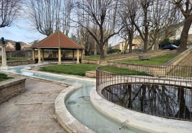
coordonnées fontaine