Trail Walking Sainte-Ode - Boucle - Forêts et plateaux- Tronçon 3 - Rechimont - Gives - Photo

Boucle - Forêts et plateaux- Tronçon 3 - Rechimont - Gives

Escapardenne, évadez-vous du quotidien GUIDE+

© OpenStreetMap contributors
Length
Length
18.3 km
Max alt
Max alt
508 m
Uphill gradient
Uphill gradient
300 m
Km-Effort
Km-Effort  
22 km
Min alt
Min alt
356 m
Downhill gradient
Downhill gradient
349 m
Boucle
Boucle
No
Creation date :
2014-12-10 00:00:00.0
Updated on :
2014-12-10 00:00:00.0

(0 Reviews)

Walking
Walking
--
Difficulty : Unknown

Scan this QR Code to open this trail in the SityTrail application

FREE GPS app for hiking

Logo SityTrail SityTrail

IGN / Geographical institutes

Download SityTrail from the App Store Download SityTrail from Google Play

Logo SityTrail SityTrail World

The world is yours!

Download SityTrail from the App Store Download SityTrail from Google Play Download SityTrail on Huawei AppGallery

About

Trail Walking of 18.3 km to be discovered at Wallonia, Luxembourg, Sainte-Ode. This trail is proposed by Escapardenne.

Description

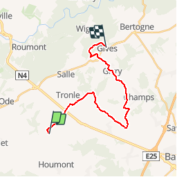
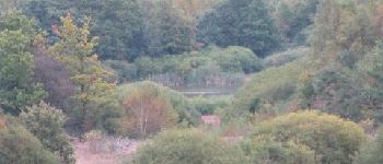
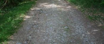
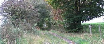
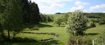
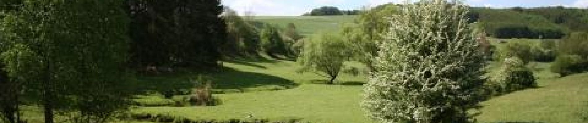
Tronçon 3 de la Boucle "Des profondeurs de la forêt aux paysages de plateaux" (98 Km).Démarrant de Rechimont, cette troisième étape vous emmène sur la commune de Bertogne. Après un passage au pied des éoliennes à proximité le nationale N4, le tracé rejoint les deux villages de Flamierge et Flamisoul où l''on retrouve quelques fermes typiquement ardennaises et la chaussée romaine.Avec des dénivelés peu importants, l''itinéraire emprunte ensuite principalement des sentiers agricoles au milieu des pâtures avant de traverser le village de Givry pour ensuite rejoindre Gives.

Elevation profile

Photos

Points of interest

Point of interest Sainte-Ode - Rechimont - L'enclos des Frênes - Photo
Escapardenne
Point of interest Sainte-Ode - Les éoliennes de Flamierge et de Sainte-Ode - Photo
Escapardenne
Point of interest Bertogne - Flamierge - Photo
Escapardenne
BERTOGNE 
Point of interest Bertogne - Chapelle et cimetière de Flamisoul - Photo
Escapardenne
Point of interest Bertogne - Plateau et fonds humides - Photo
Escapardenne
Point of interest Bertogne - Pont des Gattes - Vieux chemin en pavés - Photo
Escapardenne
Point of interest Bertogne - Panneau didactique - Photo
Escapardenne
Point of interest Bertogne - Givry - Abri de pique-nique - Photo
Escapardenne

Positioning

Country:
Belgium
Region :
Wallonia
Department/Province :
Luxembourg
Municipality :
Sainte-Ode
Location:
Tillet
Start:(UTM)
684848 ; 5543579 (31U) N.

Trails nearby

Trail Walking Sainte-Ode - RB-LUX-08 - Raccourci - De part et d’autre de l’Ourthe occidentale - Photo
Walking
PRO

Walking

Difficult
(2)
Sainte-Ode, Wallonia, Luxembourg, Belgium
15.2 km | 18.6 km-effort
4h 13min
Yes
Trail Walking Sainte-Ode - Tonny - Promenade de Tonny (A6) - Photo
Walking
GUIDE+

Walking

Medium
(3)
Sainte-Ode, Wallonia, Luxembourg, Belgium
9.5 km | 12.2 km-effort
2h 36min
Yes
Trail Walking Sainte-Ode - Beauplateau - Promenade du Pleurotte (T7) - Photo
Walking
GUIDE+

Walking

Medium
(2)
Sainte-Ode, Wallonia, Luxembourg, Belgium
5.5 km | 6.9 km-effort
1h 29min
Yes
Trail Walking Sainte-Ode - Lavacherie - Promenade de la Bonne Dame (L1) - Photo
Walking
GUIDE+

Walking

Medium
(4)
Sainte-Ode, Wallonia, Luxembourg, Belgium
7.7 km | 10 km-effort
2h 10min
Yes
Trail Walking Sainte-Ode - Amberloup, Natura 2000 - Des sites qui valent le détour. Lx11 - Photo
Walking
GUIDE+

Walking

Easy
(4)
Sainte-Ode, Wallonia, Luxembourg, Belgium
4.2 km | 5 km-effort
1h 6min
Yes
Trail Walking Sainte-Ode - RB-LUX-08 - De part et d’autre de l’Ourthe occidentale - Photo
Walking
PRO

Walking

Medium
(1)
Sainte-Ode, Wallonia, Luxembourg, Belgium
23 km | 29 km-effort
6h 14min
Yes
Trail On foot Sainte-Ode - Dans Freyr par Bokaissart - Photo
On foot
lancelot.be

On foot

Medium
(1)
Sainte-Ode, Wallonia, Luxembourg, Belgium
4.6 km | 5.9 km-effort
1h 25min
Yes
Trail Walking Sainte-Ode - Beauplateau - Le sentier du Coprin (GTA 4) - Photo
Walking
GUIDE+

Walking

Very difficult
(2)
Sainte-Ode, Wallonia, Luxembourg, Belgium
16.6 km | 20 km-effort
4h 20min
Yes
Trail Walking Sainte-Ode - Magerotte - Promenade des Haies de Magery (T4) - Photo
Walking
GUIDE+

Walking

Medium
(3)
Sainte-Ode, Wallonia, Luxembourg, Belgium
9.3 km | 11.4 km-effort
2h 29min
Yes


Close
My subscriptions