


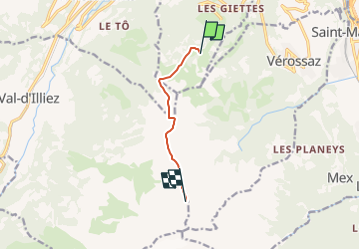
Refuge de Chalin, Dent de Valère

pnoth
User

Length
5.2 km

Max alt
2569 m

Uphill gradient
1019 m
Km-Effort
15.7 km

Min alt
1610 m

Downhill gradient
80 m
Boucle
No
Creation date :
2014-12-11 00:00:00.0
Updated on :
2014-12-11 00:00:00.0
--
Difficulty : Unknown

FREE GPS app for hiking
 SityTrail
IGN / Geographical institutes
SityTrail Plus
The world is yours!
About
Trail Other activity of 5.2 km to be discovered at Valais/Wallis, Monthey, Monthey. This trail is proposed by pnoth.
Description
English: http://www.noth.ch/h0131_e.html
Français: http://www.noth.ch/h0131_f.html
Deutsch: http://www.noth.ch/h0131_d.html
Positioning
Country:
Switzerland
Region :
Valais/Wallis
Department/Province :
Monthey
Municipality :
Monthey
Location:
Unknown
Start:(Dec)
Start:(UTM)
342032 ; 5119914 (32T) N.
Comments