


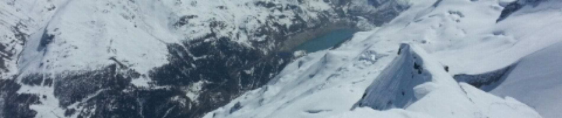
Mont pourri

melsacri
User
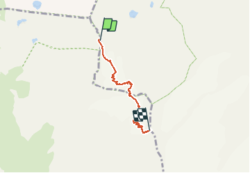

Length
5.4 km

Max alt
3750 m

Uphill gradient
816 m
Km-Effort
13.6 km

Min alt
2939 m

Downhill gradient
10 m
Boucle
No
Creation date :
2014-12-10 00:00:00.0
Updated on :
2014-12-10 00:00:00.0
2h56
Difficulty : Difficult

FREE GPS app for hiking
 SityTrail
IGN / Geographical institutes
SityTrail Plus
The world is yours!
About
Trail Other activity of 5.4 km to be discovered at Auvergne-Rhône-Alpes, Savoy, Villaroger. This trail is proposed by melsacri.
Description
glacier
Photos

Positioning
Country:
France
Region :
Auvergne-Rhône-Alpes
Department/Province :
Savoy
Municipality :
Villaroger
Location:
Unknown
Start:(Dec)
Start:(UTM)
331985 ; 5045618 (32T) N.
Comments