


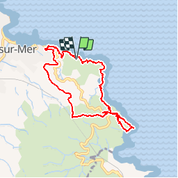
Banyuls - Cap Rederis

frizou83
User

Length
8 km

Max alt
195 m

Uphill gradient
335 m
Km-Effort
12.5 km

Min alt
6 m

Downhill gradient
334 m
Boucle
Yes
Creation date :
2014-12-10 00:00:00.0
Updated on :
2014-12-10 00:00:00.0
2h38
Difficulty : Easy

FREE GPS app for hiking
 SityTrail
IGN / Geographical institutes
SityTrail Plus
The world is yours!
About
Trail Walking of 8 km to be discovered at Occitania, Pyrénées-Orientales, Banyuls-sur-Mer. This trail is proposed by frizou83.
Positioning
Country:
France
Region :
Occitania
Department/Province :
Pyrénées-Orientales
Municipality :
Banyuls-sur-Mer
Location:
Unknown
Start:(Dec)
Start:(UTM)
512120 ; 4702807 (31T) N.
Comments
très belle vue !