Trail Mountain bike Sorbier - Sorbier, la ligne, la digue - Photo

Sorbier, la ligne, la digue

 coco03
coco03

User

© OpenStreetMap contributors
Length
Length
9.8 km
Max alt
Max alt
379 m
Uphill gradient
Uphill gradient
129 m
Km-Effort
Km-Effort  
11.6 km
Min alt
Min alt
279 m
Downhill gradient
Downhill gradient
131 m
Boucle
Boucle
Yes
Creation date :
2014-12-10 00:00:00.0
Updated on :
2014-12-10 00:00:00.0

(0 Reviews)

Mountain bike
Mountain bike
46m
Difficulty : Medium

Scan this QR Code to open this trail in the SityTrail application

FREE GPS app for hiking

Logo SityTrail SityTrail

IGN / Geographical institutes

Download SityTrail from the App Store Download SityTrail from Google Play

Logo SityTrail SityTrail World

The world is yours!

Download SityTrail from the App Store Download SityTrail from Google Play Download SityTrail on Huawei AppGallery

About

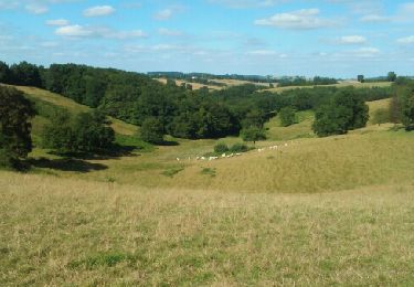
Trail Mountain bike of 9.8 km to be discovered at Auvergne-Rhône-Alpes, Allier, Sorbier. This trail is proposed by coco03.

Description

Passage sur l'ancienne ligne du tacot (Ancien train qui transporté la charbon.

Elevation profile

Positioning

Country:
France
Region :
Auvergne-Rhône-Alpes
Department/Province :
Allier
Municipality :
Sorbier
Location:
Unknown
Start:(Dec)
Start:(UTM)
552691 ; 5134453 (31T) N.

Trails nearby

Trail Walking Bert - Boucle du Roc - BERT - Photo
Walking
coco03

Walking

Medium
(1)
Bert, Auvergne-Rhône-Alpes, Allier, France
12.5 km | 16.6 km-effort
3h 36min
Yes
Trail Walking Saint-Léon - St Leon à Barrais-Bussolles  - Photo
Walking
NANE51

Walking

Easy
Saint-Léon, Auvergne-Rhône-Alpes, Allier, France
20 km | 27 km-effort
5h 8min
No
Trail Walking Bert - Bert, la Tour Pouçain - Photo
Walking
coco03

Walking

Medium
(1)
Bert, Auvergne-Rhône-Alpes, Allier, France
11.4 km | 14.7 km-effort
3h 19min
No
Trail Walking Sorbier - Montcombroux-Bert - Photo
Walking
coco03

Walking

Medium
Sorbier, Auvergne-Rhône-Alpes, Allier, France
7.2 km | 9.3 km-effort
2h 5min
Yes
Trail Walking Sorbier - Sorbier Long - Photo
Walking
danou56

Walking

Easy
Sorbier, Auvergne-Rhône-Alpes, Allier, France
9.3 km | 11 km-effort
2h 24min
Yes
Trail Walking Sorbier - Sorbier Court - Photo
Walking
danou56

Walking

Easy
Sorbier, Auvergne-Rhône-Alpes, Allier, France
6.6 km | 8 km-effort
1h 44min
Yes
Trail Walking Le Donjon - Le Fetrez - Photo
Walking
coco03

Walking

Medium
Le Donjon, Auvergne-Rhône-Alpes, Allier, France
10.2 km | 12.8 km-effort
2h 47min
Yes
Trail Cycle Bert - Bert-Nuits st Georges - Photo
Cycle
NOVICLIE

Cycle

Easy
Bert, Auvergne-Rhône-Alpes, Allier, France
163 km | 183 km-effort
Unknown
No
Trail Walking Le Donjon - Le Fetrez Bert - Photo
Walking
JFL03

Walking

Easy
Le Donjon, Auvergne-Rhône-Alpes, Allier, France
46 km | 57 km-effort
2h 39min
No


Close
My subscriptions