Trail Walking Istres - Entre ville et nature - Istres - Photo
 tracegps
tracegps

User

© OpenStreetMap contributors
Length
Length
12.3 km
Max alt
Max alt
71 m
Uphill gradient
Uphill gradient
177 m
Km-Effort
Km-Effort  
14.7 km
Min alt
Min alt
-1 m
Downhill gradient
Downhill gradient
177 m
Boucle
Boucle
Yes
Creation date :
2014-12-10 00:00:00.0
Updated on :
2014-12-10 00:00:00.0

(2 Reviews)

Walking
Walking
4h00
Difficulty : Difficult

Scan this QR Code to open this trail in the SityTrail application

FREE GPS app for hiking

Logo SityTrail SityTrail

IGN / Geographical institutes

Download SityTrail from the App Store Download SityTrail from Google Play

Logo SityTrail SityTrail World

The world is yours!

Download SityTrail from the App Store Download SityTrail from Google Play Download SityTrail on Huawei AppGallery

About

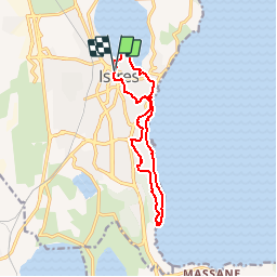
Trail Walking of 12.3 km to be discovered at Provence-Alpes-Côte d'Azur, Bouches-du-Rhône, Istres. This trail is proposed by tracegps.

Description

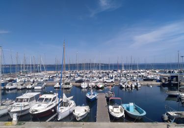
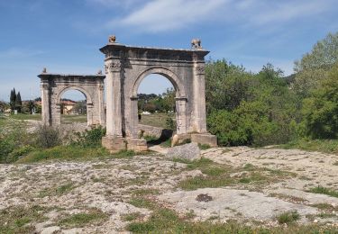
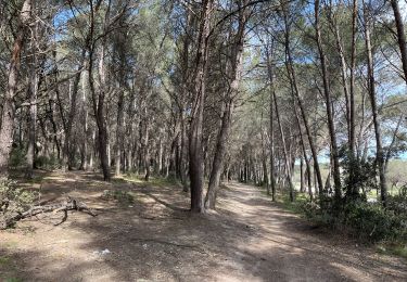
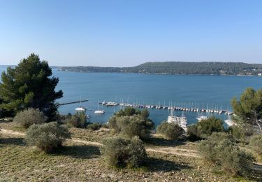
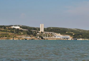
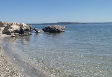
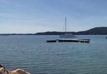
Circuit proposé? et au départ de l'Office de Tourisme d'Istres, 30 allée Jean Jaurès. Avez-vous souvent l’occasion lors d’une randonnée de mélanger patrimoine urbain et nature ? C’est ce que vous propose ce circuit insolite. Parcourez le centre historique et la ville pour plonger dans l’ambiance typique des villages provençaux. Découvrez aussi l’étang de Berre sous différents angles de vues. Surplombez le depuis les belvédères. Laissez glisser votre regard sur la plus grande mer intérieure d’Europe et son histoire complexe. Longez le littoral et profitez des criques préservées. Un rendez-vous à ne pas manquer !

Elevation profile

Photos

Positioning

Country:
France
Region :
Provence-Alpes-Côte d'Azur
Department/Province :
Bouches-du-Rhône
Municipality :
Istres
Location:
Unknown
Start:(UTM)
660648 ; 4819908 (31T) N.

Comments

Please log in to post a review or rate the element


très agréable


Trails nearby

Trail On foot Istres - Entre ville et nature (Istres) - Photo
On foot
PRO

On foot

Easy
Istres, Provence-Alpes-Côte d'Azur, Bouches-du-Rhône, France
13.3 km | 15.7 km-effort
3h 34min
Yes
Trail Walking Istres - Miramas Istres GR 2013 ALLER - Photo
Walking
hervef13300

Walking

Easy
(2)
Istres, Provence-Alpes-Côte d'Azur, Bouches-du-Rhône, France
7.6 km | 10 km-effort
2h 6min
No
Trail Walking Saint-Chamas - St Chamas la Touloubre - Photo
Walking
nana1643

Walking

Easy
Saint-Chamas, Provence-Alpes-Côte d'Azur, Bouches-du-Rhône, France
9.3 km | 11.5 km-effort
4h 10min
Yes
Trail Walking Istres - Martigues entre les étangs de Citis et Lavalduc - Photo
Walking
jll7513

Walking

Medium
Istres, Provence-Alpes-Côte d'Azur, Bouches-du-Rhône, France
6.9 km | 8.3 km-effort
1h 53min
Yes
Trail Walking Saint-Chamas - St chamas - Photo
Walking
gaggiroland

Walking

Very easy
Saint-Chamas, Provence-Alpes-Côte d'Azur, Bouches-du-Rhône, France
12 km | 14.3 km-effort
3h 23min
No
Trail On foot Saint-Chamas - La petite Camargue - Photo
On foot
PRO

On foot

Easy
Saint-Chamas, Provence-Alpes-Côte d'Azur, Bouches-du-Rhône, France
3.7 km | 3.9 km-effort
53min
Yes
Trail Walking Berre-l'Étang - St Chamas variante patrimoine - Photo
Walking
Manoune

Walking

Medium
Berre-l'Étang, Provence-Alpes-Côte d'Azur, Bouches-du-Rhône, France
14.9 km | 17.7 km-effort
5h 33min
Yes
Trail Walking Istres - plage du ranquet Istres  - Photo
Walking
nana1643

Walking

Easy
Istres, Provence-Alpes-Côte d'Azur, Bouches-du-Rhône, France
8.8 km | 10.3 km-effort
2h 32min
Yes
Trail Walking Saint-Chamas - 04/04/2024 St chamas - Photo
Walking
nana1643

Walking

Easy
Saint-Chamas, Provence-Alpes-Côte d'Azur, Bouches-du-Rhône, France
9.6 km | 11.9 km-effort
2h 41min
Yes


Close
My subscriptions