Trail Walking Ajoux - Le rocher de Gourdon - Ajoux - Photo

Le rocher de Gourdon - Ajoux

 tracegps
tracegps

User

© OpenStreetMap contributors
Length
Length
16.9 km
Max alt
Max alt
884 m
Uphill gradient
Uphill gradient
553 m
Km-Effort
Km-Effort  
24 km
Min alt
Min alt
520 m
Downhill gradient
Downhill gradient
555 m
Boucle
Boucle
Yes
Creation date :
2014-12-10 00:00:00.0
Updated on :
2014-12-10 00:00:00.0

(1 Reviews)

Walking
Walking
4h30
Difficulty : Difficult

Scan this QR Code to open this trail in the SityTrail application

FREE GPS app for hiking

Logo SityTrail SityTrail

IGN / Geographical institutes

Download SityTrail from the App Store Download SityTrail from Google Play

Logo SityTrail SityTrail World

The world is yours!

Download SityTrail from the App Store Download SityTrail from Google Play Download SityTrail on Huawei AppGallery

About

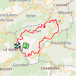
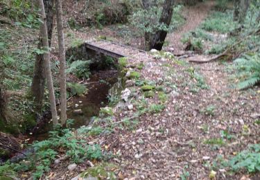
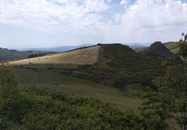
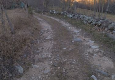
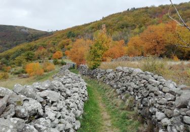
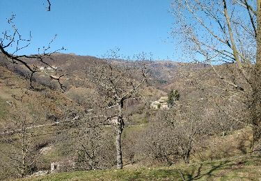
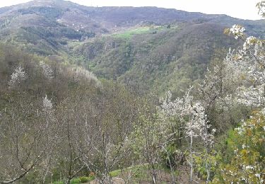
Trail Walking of 16.9 km to be discovered at Auvergne-Rhône-Alpes, Ardèche, Ajoux. This trail is proposed by tracegps.

Description

Boucle de 17 km sur la commune d'Ajoux, au départ du col de Sarasset.

Elevation profile

Photos

Positioning

Country:
France
Region :
Auvergne-Rhône-Alpes
Department/Province :
Ardèche
Municipality :
Ajoux
Location:
Unknown
Start:(UTM)
615662 ; 4954977 (31T) N.

Comments

Please log in to post a review or rate the element


Trails nearby

Trail Walking Saint-Étienne-de-Boulogne - Le Rastelas 14km - Photo
Walking
GUIDE
thonyc

Walking

Difficult
Saint-Étienne-de-Boulogne, Auvergne-Rhône-Alpes, Ardèche, France
13.8 km | 21 km-effort
4h 24min
Yes
Trail Walking Gourdon - Col de la Fayolle - Rocher de Gourdon  - Photo
Walking
coureursdecretes

Walking

Difficult
(1)
Gourdon, Auvergne-Rhône-Alpes, Ardèche, France
12.4 km | 17.1 km-effort
5h 10min
No
Trail Walking Pourchères - Pourcheres 14km - Photo
Walking
GUIDE
thonyc

Walking

Medium
Pourchères, Auvergne-Rhône-Alpes, Ardèche, France
14.1 km | 21 km-effort
4h 0min
Yes
Trail Walking Ajoux - 07 sarrasset ajoux - Photo
Walking
himba26100

Walking

Medium
Ajoux, Auvergne-Rhône-Alpes, Ardèche, France
16.3 km | 25 km-effort
7h 3min
No
Trail Road bike Saint-Michel-de-Boulogne - Saint Joseph des bancs - Photo
Road bike
nadd73

Road bike

Medium
Saint-Michel-de-Boulogne, Auvergne-Rhône-Alpes, Ardèche, France
49 km | 64 km-effort
3h 24min
Yes
Trail Walking Saint-Joseph-des-Bancs - 07 st joseph les bancs - Photo
Walking
himba26100

Walking

Easy
Saint-Joseph-des-Bancs, Auvergne-Rhône-Alpes, Ardèche, France
18.4 km | 29 km-effort
7h 47min
Yes
Trail Walking Saint-Étienne-de-Serre - St Etienne de Serre 15km - Photo
Walking
GUIDE
thonyc

Walking

Medium
Saint-Étienne-de-Serre, Auvergne-Rhône-Alpes, Ardèche, France
15 km | 24 km-effort
5h 33min
Yes
Trail Walking Saint-Joseph-des-Bancs - Tce St Joseph 20-02-17 - Photo
Walking
coureursdecretes

Walking

Very easy
Saint-Joseph-des-Bancs, Auvergne-Rhône-Alpes, Ardèche, France
13 km | 20 km-effort
5h 9min
Yes
Trail Walking Saint-Étienne-de-Serre - Sablas Magerouan Mauves le pont du Moulin - Photo
Walking
alaindurbecq

Walking

Medium
Saint-Étienne-de-Serre, Auvergne-Rhône-Alpes, Ardèche, France
11.5 km | 18.4 km-effort
4h 55min
Yes


Close
My subscriptions