Trail Cycle Saint-Viâtre - La route touristique des étangs - St Viâtre - Photo

La route touristique des étangs - St Viâtre

 tracegps
tracegps

User

© OpenStreetMap contributors
Length
Length
19.7 km
Max alt
Max alt
130 m
Uphill gradient
Uphill gradient
140 m
Km-Effort
Km-Effort  
22 km
Min alt
Min alt
95 m
Downhill gradient
Downhill gradient
141 m
Boucle
Boucle
Yes
Creation date :
2014-12-10 00:00:00.0
Updated on :
2014-12-10 00:00:00.0

(1 Reviews)

Cycle
Cycle
1h00
Difficulty : Easy

Scan this QR Code to open this trail in the SityTrail application

FREE GPS app for hiking

Logo SityTrail SityTrail

IGN / Geographical institutes

Download SityTrail from the App Store Download SityTrail from Google Play

Logo SityTrail SityTrail World

The world is yours!

Download SityTrail from the App Store Download SityTrail from Google Play Download SityTrail on Huawei AppGallery

About

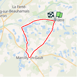
Trail Cycle of 19.7 km to be discovered at Centre-Loire Valley, Loir-et-Cher, Saint-Viâtre. This trail is proposed by tracegps.

Description

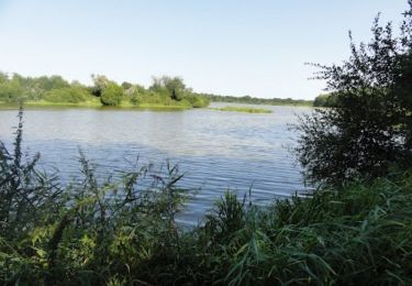
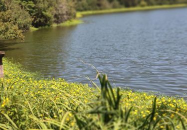
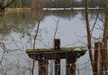
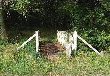
Un circuit entre Saint-Viâtre et Marcilly-en-Gault, permet d’apprécier la zone la plus dense des étangs de Sologne et sa grande richesse écologique et paysagère. Au départ de la maison des étangs prendre la direction de Vernou en Sologne sur 5 km. Au carrefour prendre à gauche la direction du village de Marcilly-en-Gault où l’on prend la direction de Saint-Viâtre pour le retour. Retrouvez le plan du circuit sur le site de la maison des étangs.

Elevation profile

Photos

Positioning

Country:
France
Region :
Centre-Loire Valley
Department/Province :
Loir-et-Cher
Municipality :
Saint-Viâtre
Location:
Unknown
Start:(UTM)
419683 ; 5263694 (31T) N.

Comments

Please log in to post a review or rate the element


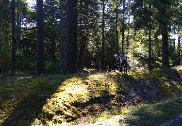
itinéraire sympathique sur les petites routes de Sologne.


Trails nearby

Trail Walking Saint-Viâtre - Circuit des Veignaux - St Viâtre - Photo
Walking
tracegps

Walking

Medium
Saint-Viâtre, Centre-Loire Valley, Loir-et-Cher, France
10.5 km | 11.4 km-effort
2h 34min
Yes
Trail Cycle Saint-Viâtre - Route des étangs - Photo
Cycle
verpoorten

Cycle

Medium
(1)
Saint-Viâtre, Centre-Loire Valley, Loir-et-Cher, France
31 km | 34 km-effort
2h 30min
Yes
Trail Walking Saint-Viâtre - Saint viatre - Photo
Walking
lecmic

Walking

Easy
Saint-Viâtre, Centre-Loire Valley, Loir-et-Cher, France
21 km | 23 km-effort
3h 21min
Yes
Trail Walking Saint-Viâtre - chemin ferré  - Photo
Walking
damiendrieu

Walking

Very easy
Saint-Viâtre, Centre-Loire Valley, Loir-et-Cher, France
8.8 km | 9.7 km-effort
2h 35min
No
Trail Cycle Saint-Viâtre - route des etangs - Photo
Cycle
f.bqn

Cycle

Easy
Saint-Viâtre, Centre-Loire Valley, Loir-et-Cher, France
21 km | 23 km-effort
1h 52min
No
Trail Mountain bike Saint-Viâtre - les veignaux - Photo
Mountain bike
f.bqn

Mountain bike

Very easy
Saint-Viâtre, Centre-Loire Valley, Loir-et-Cher, France
12.9 km | 14.1 km-effort
56min
Yes
Trail sport Saint-Viâtre - nouan - Photo
sport
jpmanon

sport

Very easy
Saint-Viâtre, Centre-Loire Valley, Loir-et-Cher, France
105 km | 115 km-effort
Unknown
Yes
Trail Other activity Saint-Viâtre - Saint viatre - Photo
Other activity
murph

Other activity

Very easy
Saint-Viâtre, Centre-Loire Valley, Loir-et-Cher, France
19.7 km | 22 km-effort
3h 32min
Yes


Close
My subscriptions